Upper Mustang Trek: A Complete Guide to the Route, Lo Manthang and Best Time
The Upper Mustang trek is a 16-day journey into the former Kingdom of Lo, a high desert region north of the Annapurnas that was closed to foreign visitors until 1992. MountainKick’s route starts at Kagbeni, follows the Kali Gandaki valley north to the walled city of Lo Manthang, then returns by a different trail through Ghar Gompa and Dhakmar.
It’s a moderate trek with long, exposed walking days and strong afternoon winds. Much of the route is above 3,000m, with the highest point at about 4,280m on the Chogo La. Upper Mustang sits in the rain shadow of the Annapurna and Dhaulagiri ranges, which makes it one of Nepal’s better options for trekking during the monsoon.
You need an Upper Mustang Restricted Area Permit, an Annapurna Conservation Area Permit and a licensed guide. Since March 2026, a solo traveller can get their own restricted area permit without a second trekker, but must still travel with a licensed guide through a registered trekking agency.
- Duration: 16 days from Kathmandu, about 10 days walking
- Highest point: about 4,280m at the Chogo La
- Lo Manthang: 3,840m
- Difficulty: moderate, with several 5 to 8 hour walking days
- Best time: March to November, including the monsoon
- Restricted area permit: USD 50 per person per day inside Upper Mustang
- ACAP: NPR 3,000 per person
- Guide: a licensed guide is required inside the restricted area
- Solo trekking: one trekker can now get the permit, but unguided trekking isn’t allowed
- Getting there: flight from Pokhara to Jomsom, or a long jeep journey
- MountainKick price: from USD 1,480 per person
- Full cost: see our Upper Mustang trek cost guide
Last updated: October 2026
What Makes Upper Mustang Different
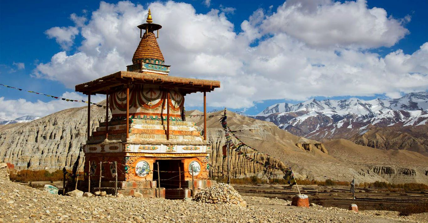
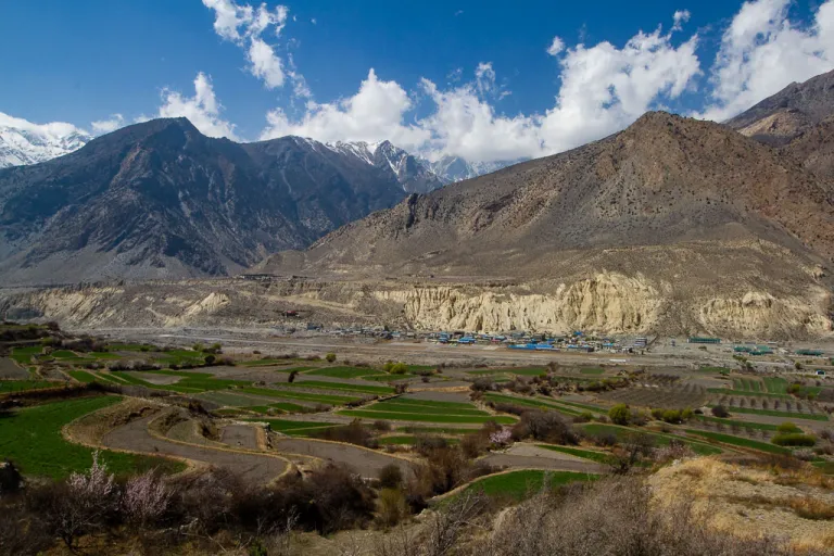
Upper Mustang feels like nowhere else in Nepal. Once you cross into the restricted area at Kagbeni, the green hills disappear. You walk through high desert cliffs, cave dwellings and windswept valleys that look more like Tibet than the rest of the Himalaya.
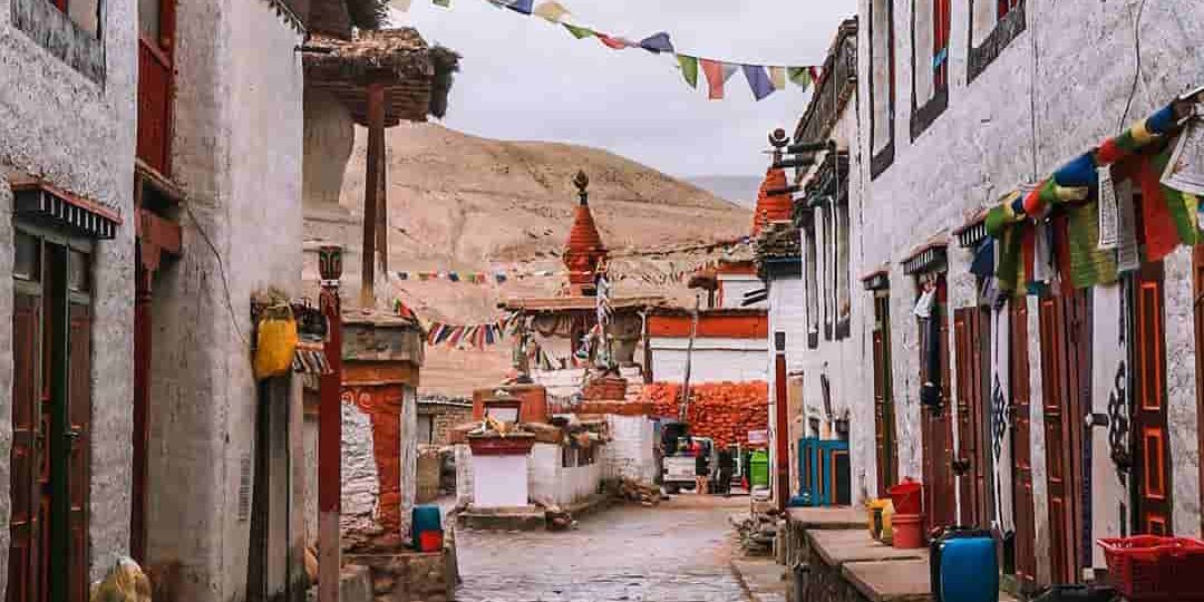
This was the Kingdom of Lo, which kept its traditional monarchy until Nepal became a republic in 2008. Its walled capital, Lo Manthang, was established in the 14th century, and foreigners weren’t allowed in until 1992. Tibetan Buddhist culture is still strong here. Villages are built of mud brick and whitewashed stone, and old monasteries sit above fields of barley and buckwheat.
The restricted area permit keeps visitor numbers lower than on Nepal’s busiest routes, so the trail generally feels much quieter than Everest Base Camp or the main Annapurna trails.
The Upper Mustang Route, Day by Day
Upper Mustang has several route variations. MountainKick’s 16-day route is a loop: you walk up the valley to Lo Manthang, then return by a quieter trail via Ghar Gompa and Dhakmar.
Kathmandu to Kagbeni (Days 1 to 3). After a night in Kathmandu and a drive to Pokhara, a short flight takes you to Jomsom on the Kali Gandaki. From there it’s about 3 hours on foot to Kagbeni (2,800m), the gateway to the Upper Mustang restricted area.
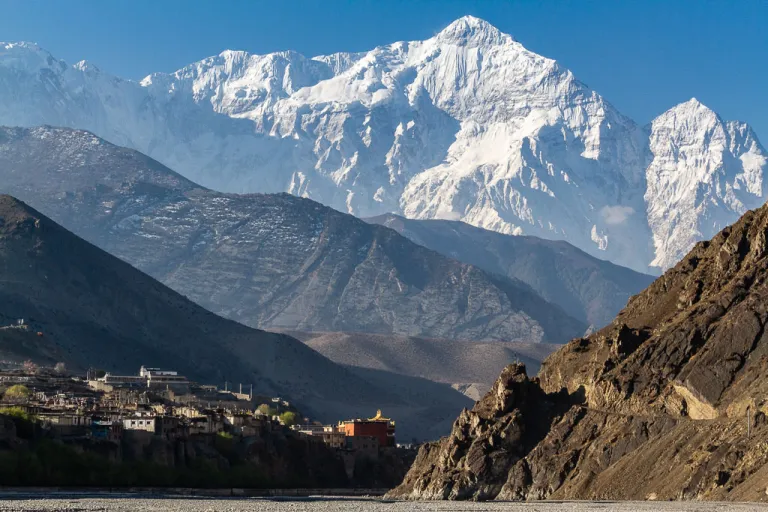
Kagbeni to Chele (Day 4, 3,050m). The landscape changes fast. You climb into dry, wind-carved hills, cross the Kali Gandaki and pass through the narrow alleys of Tangbe before reaching Chele.
Chele to Geling (Day 5, 3,570m). A long day of 7 to 8 hours over exposed ridges and small passes, through Samar and Syangboche. The wind usually picks up by midday.
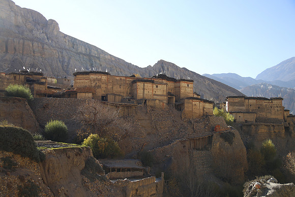
Geling to Charang (Day 6, 3,560m). You cross the Nyi La at roughly 4,000m and drop to Ghami, one of the larger villages in Upper Mustang, with its long mani wall. From there the trail crosses farmland to Charang, where a centuries-old palace and monastery stand above the village.
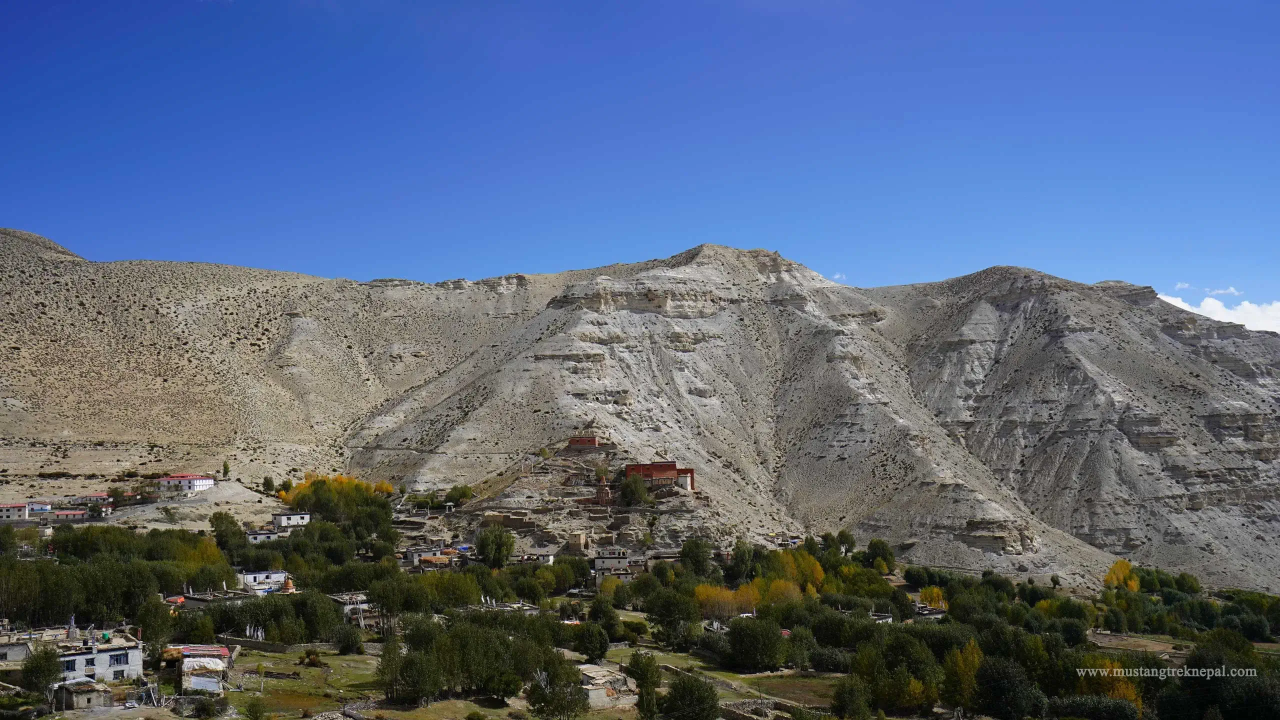
Charang to Lo Manthang (Day 7, 3,840m). A steady climb over rocky ground until the walled city comes into view.
Exploring Lo Manthang (Day 8). A full day around the city, including the hilltop Namgyal Gompa and the old fortress ruins at Tingkar.
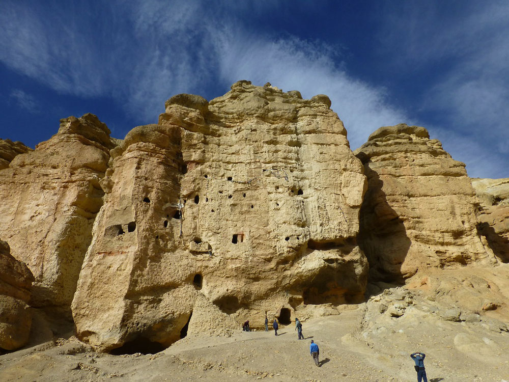
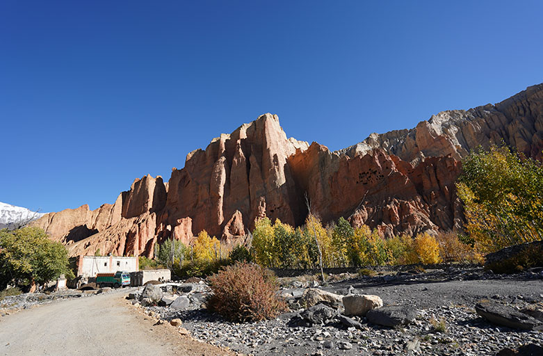
Lo Manthang to Dhakmar (Day 9, 3,820m). You leave on a quieter trail and climb to the Chogo La at about 4,280m, the highest point of the trek. On the way down you stop at Ghar Gompa, a monastery that tradition says was founded by Guru Padmasambhava in the 8th century. Dhakmar is known for its red sandstone cliffs and cave dwellings.
Dhakmar to Syangboche (Day 10, 3,800m). A mostly downhill day, back through Ghami’s fields to rejoin the main trail at Syangboche.
Back to Jomsom (Days 11 and 12). A long descent through the cliffs and caves of Chhusang to Tetang, close to 1,000m down, then an easier walk along the river to Jomsom.
Return to Kathmandu (Days 13 to 16). A flight back to Pokhara, a free day by the lake, the drive to Kathmandu and a farewell dinner.
For the full itinerary with distances and walking times, see our Upper Mustang Trek page.
Lo Manthang: What to See
You spend two nights in Lo Manthang, and it’s worth every hour.
- The walled city: narrow lanes inside the old walls, past homes that have stood for centuries
- The royal palace: the former home of the kings of Lo, in the centre of the city
- The monasteries: Lo Manthang’s old gompas are known for their wall paintings
- Namgyal Gompa: a hilltop monastery west of the city, with wide views over the valley
- Tingkar: a village with the ruins of an old fortress
Some trekkers also visit the cave complexes north of Lo Manthang. If that’s on your list, ask us about adding it.
How Hard Is the Upper Mustang Trek?
Upper Mustang is a moderate trek. There’s no technical climbing on the standard trekking route, and the highest point, the Chogo La at about 4,280m, is well below the high passes on the Everest or Annapurna Circuit treks. A few things still make it harder than it looks on paper:
- Long days: several days are 6 to 8 hours of walking
- Wind: strong winds pick up most afternoons, often with dust
- Exposure: there’s little shade, and the sun is strong at altitude
- Big descents: the return to Tetang drops close to 1,000m in a day
- Altitude: you spend most of the trek above 3,000m, so acclimatisation still matters
If you’re comfortable walking 6 to 8 hours on consecutive days and have some experience of long days at altitude, you should be well prepared for this trek. See our Nepal trek difficulty guide and altitude sickness guide.
Best Time to Trek Upper Mustang
Upper Mustang sits in the rain shadow of the Annapurna and Dhaulagiri ranges, so it gets far less rain than the rest of Nepal.
- Spring (March to May): settled weather and clear skies. The Tiji festival is usually held in Lo Manthang in May, with dates set by the Tibetan calendar.
- Monsoon (June to August): one of the few treks in Nepal that works in the monsoon. The trail stays mostly dry, but flights between Pokhara and Jomsom can be delayed by cloud, so allow buffer days.
- Autumn (September to November): clear views and good trekking weather, getting colder by November.
- Winter (December to February): very cold, and accommodation becomes much more limited as many local families move to lower elevations. We don’t recommend it.
For other treks month by month, see our guide to the best time to trek in Nepal.
Permits for Upper Mustang
Upper Mustang is a restricted area. You need:
- Upper Mustang Restricted Area Permit: USD 50 per person per day inside the restricted area, counted from entry at Kagbeni. The old 10-day minimum has been removed.
- Annapurna Conservation Area Permit (ACAP): NPR 3,000 per person
The restricted area permit is arranged through a registered trekking agency, and a licensed guide is required. For the full cost breakdown, see our Upper Mustang trek cost guide.
What’s Changed for Upper Mustang in 2026?
The Upper Mustang permit system has changed. The previous USD 500 minimum for the first 10 days was removed, and the current rate is USD 50 per person per day inside the restricted area, so shorter stays can now have a lower permit cost.
In March 2026, Nepal also removed the requirement for a minimum of two trekkers on a restricted area permit. A solo traveller can now hold the permit alone, but must still travel with a licensed guide through a registered trekking agency.
Getting to Upper Mustang
Most trekkers fly from Pokhara to Jomsom, a roughly 20-minute flight that normally operates in the morning when winds are lighter. The alternative is a long jeep journey that can take most of a day, depending on road conditions. For the options in detail, see our guide to getting from Pokhara to Jomsom.
Who Is Upper Mustang Best For?
It’s a great fit if you:
- Want culture and landscape more than big mountain close-ups
- Want a quiet trail away from the crowds
- Have to trek in the monsoon
- Have done a classic trek and want something completely different
It may not suit you if you:
- Want to be close to big snow peaks every day
- Are on a tight budget, since the permit makes it one of Nepal’s pricier treks
- Want forest and green valleys
If you like the Kali Gandaki valley but want more mountains, the Annapurna Circuit follows the same corridor with a high pass.
Frequently Asked Questions
How long is the Upper Mustang trek?
MountainKick’s trek is 16 days from Kathmandu, with about 10 days of walking and two nights in Lo Manthang.
How high does the Upper Mustang trek go?
The highest point is the Chogo La at about 4,280m, crossed on the way back from Lo Manthang. Lo Manthang itself is at 3,840m.
Is Upper Mustang hard?
It’s moderate. There’s no technical climbing, but expect long days, strong wind and most of the trek above 3,000m.
Can you trek Upper Mustang in the monsoon?
Yes. It’s in a rain shadow, so it stays mostly dry from June to August. Flights to Jomsom can still be delayed, so allow buffer days.
Do you need a guide for Upper Mustang?
Yes. It’s a restricted area, so you need a licensed guide and a restricted area permit arranged through a registered agency. Since March 2026 a solo trekker can hold the permit alone, but still needs a guide.
How much does the Upper Mustang trek cost?
MountainKick’s 16-day trek starts at $1,480 per person. Most trekkers budget $2,000 to $3,000 in total before international flights and insurance. See our Upper Mustang trek cost guide.
When is the Tiji festival?
Usually in May in Lo Manthang. Dates follow the Tibetan calendar, so check the exact dates for your year before you book.
Planning an Upper Mustang trek?
Talk directly with our Kathmandu team about dates, permits and the best season for you. WhatsApp: +977 985 118 2718.
View the Upper Mustang Trek → Ask us anything →