

Kanchenjunga Circuit Trek
Trek the full circuit around the world's third highest peak, reaching both base camps across 21 days in Nepal's most remote restricted region.
On The Trail
What It Really Looks Like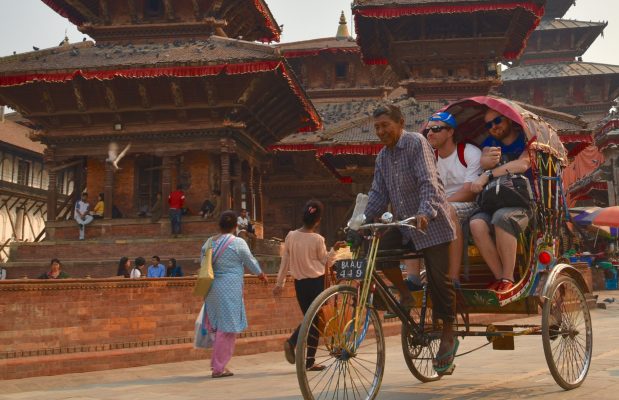
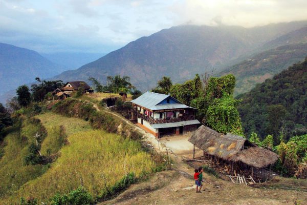
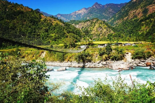
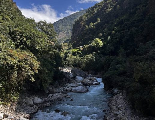
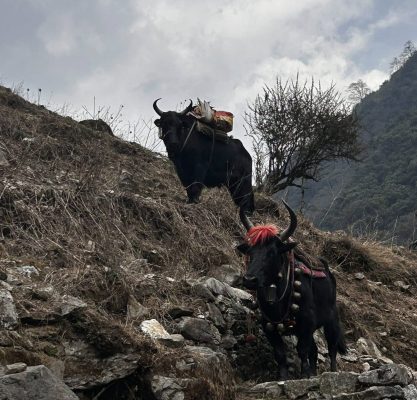
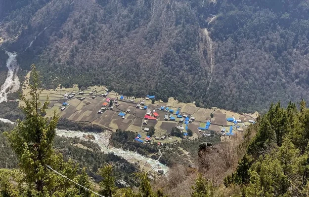
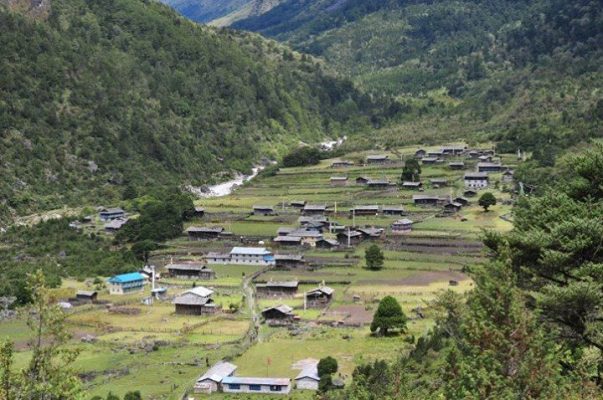
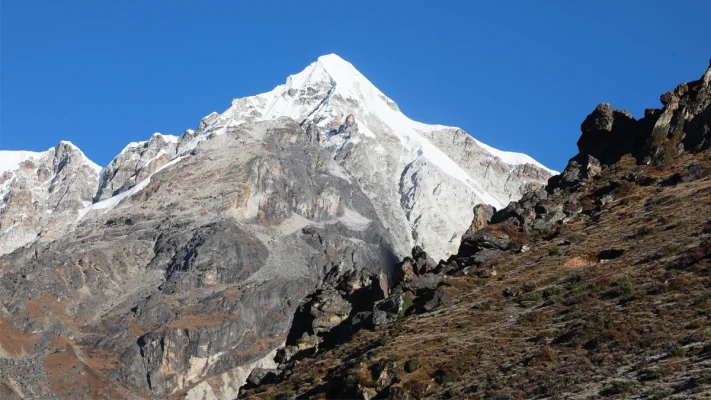
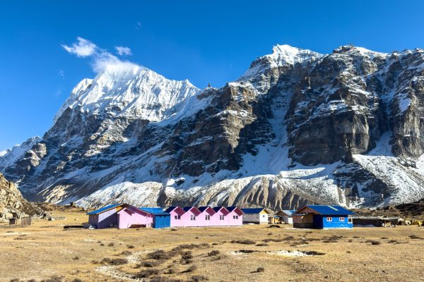
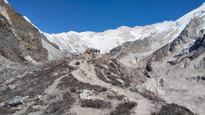
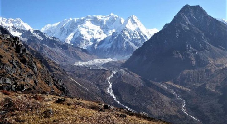

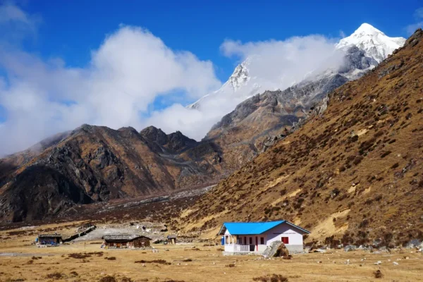
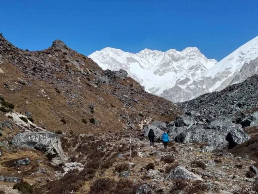
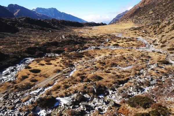
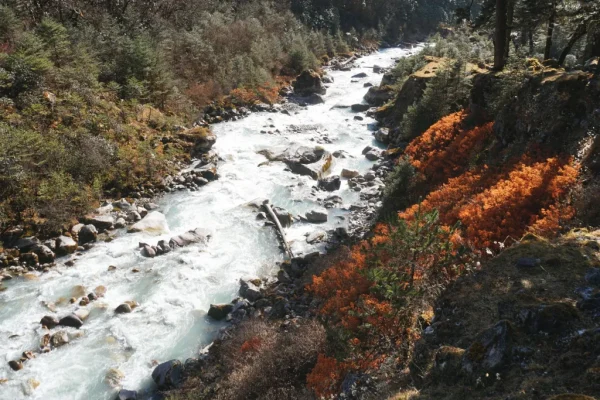
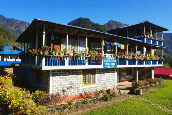
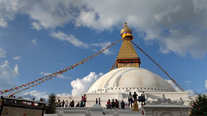
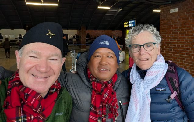
Kanchenjunga Circuit Trek: What to Expect
Pangpema North at 5,143m and Oktang South at 4,730m on one circuit
Four passes in a single day, the hardest day on any Nepal teahouse trek
Government licensed guides from eastern Nepal who know this route
KCAP and Restricted Area Permit arranged before departure
The Kanchenjunga Circuit is a 21-day teahouse trek around the world’s third highest mountain in Nepal’s far east. The region opened to trekkers in 1988 and restricted area permits have kept visitor numbers low ever since. You fly from Kathmandu to Bhadrapur, drive 7 to 8 hours to Taplejung, and walk roughly 200km from Sekathum through four distinct cultural zones to reach both base camps on opposite sides of the mountain. The north side reaches Pangpema at 5,143m. The south side reaches Oktang at 4,730m, where four Kanchenjunga summits above 8,400m are visible at once.
This is not the right trek for a first visit to Nepal. Previous completion of a major high-altitude route above 5,000m is the minimum preparation. The Sele La traverse on Day 14 crosses four passes back to back with no teahouse between start and finish and takes 8 to 10 hours. Three other days exceed 7 hours on demanding terrain. Above Ghunsa there is no road access, no mobile signal and no medical facility. Any serious emergency means helicopter evacuation, which from this region costs $5,000 to $15,000. Travel insurance covering that amount is mandatory.
MountainKick runs Kanchenjunga with government licensed guides experienced on this specific circuit. The two restricted area permits are handled before departure. All trail meals are included throughout the full 21 days. For trekkers who have already done Everest Base Camp or the Manaslu Circuit and want to understand what Nepal trekking looks like without the crowds, this is where to go next. Read our Kanchenjunga Circuit guide and Altitude Sickness guide before booking.
Day-by-Day Itinerary
Arrive in Kathmandu
Your guide meets you at Tribhuvan Airport and transfers you to your hotel in Thamel. The evening briefing covers the full 21-day circuit, both restricted area permits, gear check and the Bhadrapur flight logistics for tomorrow. The Kanchenjunga circuit requires more preparation than a standard Nepal trek so arrive rested and allow the full briefing time.

Fly to Bhadrapur, Drive to Taplejung
A 45-minute flight to Bhadrapur in the eastern Terai followed by a 7 to 8 hour drive through Ilam, Phidim and Taplethok to Taplejung. The road climbs steadily from the subtropical plains through Nepal’s tea-growing heartland and Limbu villages. Taplejung is the district headquarters and the primary gateway for Kanchenjunga trekkers with the last reliable internet access before the trail begins.
Drive to Sekathum, First Walk
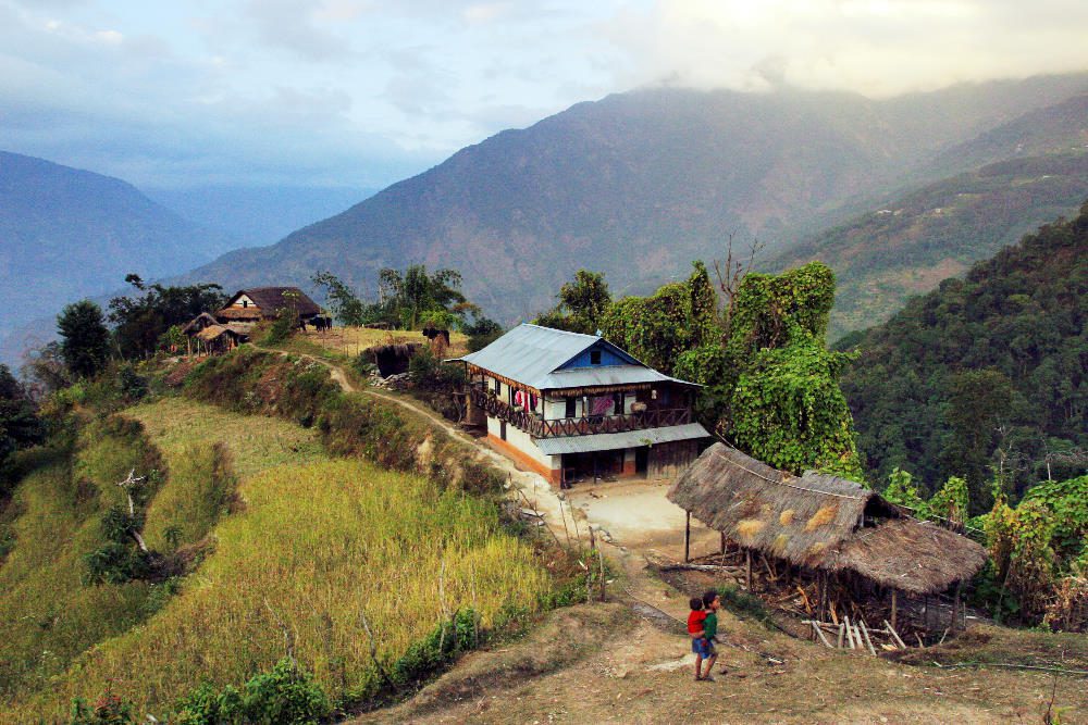
A 3 to 4 hour 4WD drive from Taplejung descends through terraced hillsides to Sekathum at the confluence of the Tamur and Ghunsa Khola rivers. The road extension here cuts two days from the traditional approach on foot. On arrival a short 1 to 2 hour walk north along the Ghunsa Khola settles the legs after two days of travel and gives the first proper look at the valley ahead. Your guide runs a final gear and permit check before the trail begins tomorrow.
Trek to Amjilosa
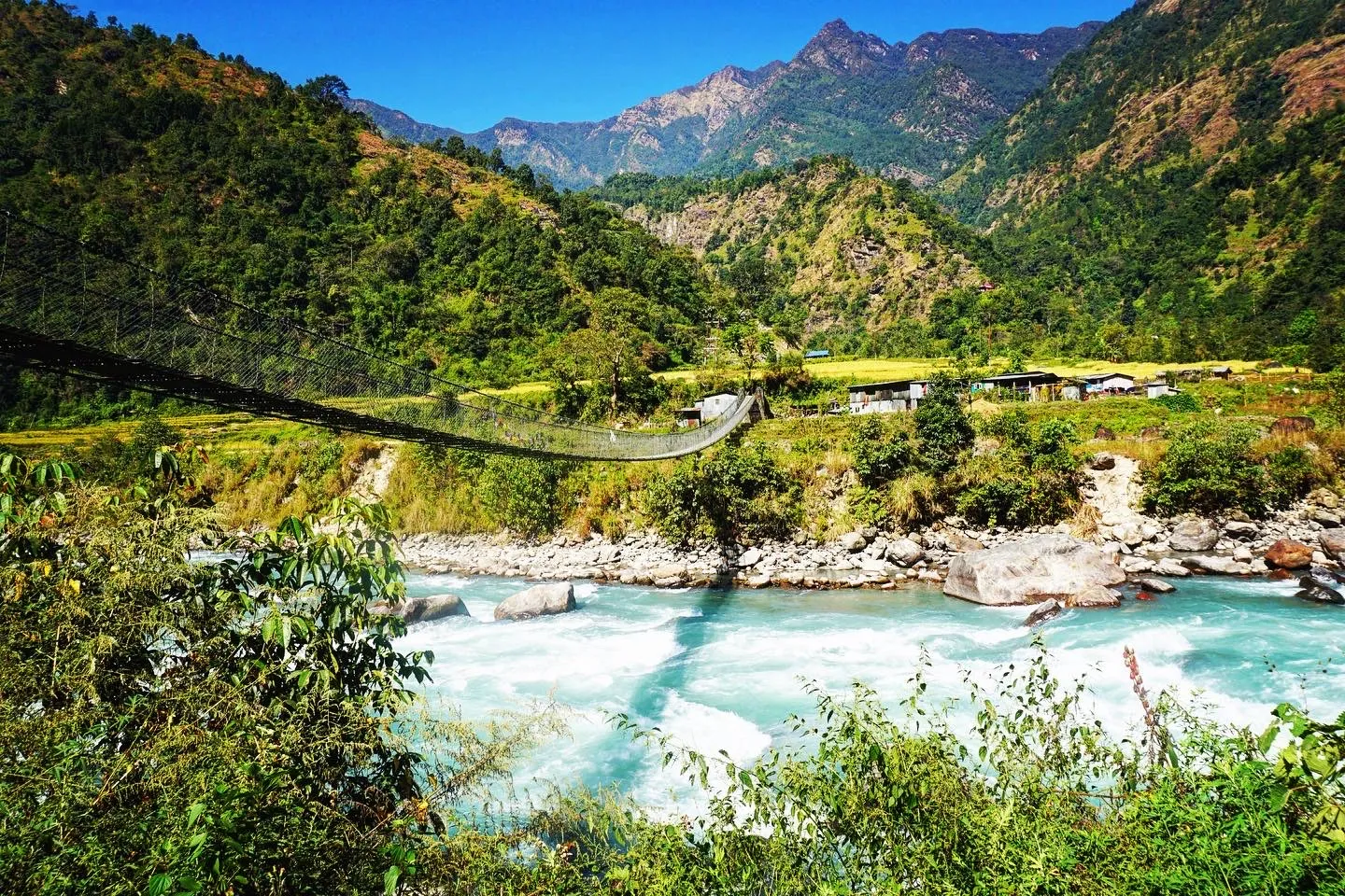
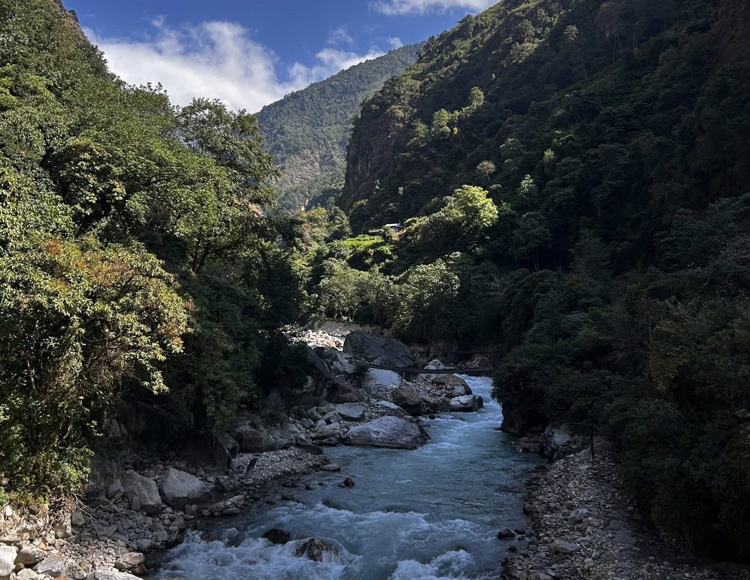
The first full day on trail follows the Ghunsa Khola northeast through forest and traditional settlements gaining 945m. Vegetation starts subtropical at river level and shifts to mixed temperate forest as you climb. River crossings are straightforward in dry season but can run fast after heavy rain. Amjilosa is the first Tibetan-influenced settlement on the route, marked by stone houses, prayer flags and mani walls that signal the cultural shift from the Limbu-dominated lower valley.
Trek to Gyabla
A shorter day climbing through bamboo and rhododendron forest following the Ghunsa Khola through increasingly dramatic gorge scenery. A significant waterfall is visible from the trail approximately midway through the day and makes a natural rest stop. Gyabla is a small Tibetan settlement with basic teahouse infrastructure and the first open views of snow-capped peaks in the distance.
Trek to Ghunsa
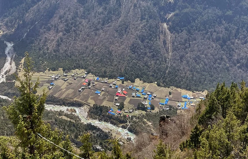
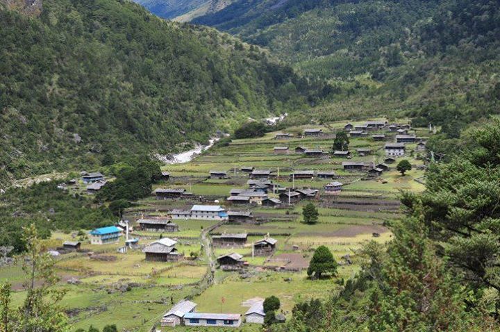
A significant elevation day gaining 865m to reach Ghunsa, the largest permanent settlement in the upper Kanchenjunga region. The trail climbs through pine and oak forest before emerging into the open valley where the village sits. Ghunsa has a functioning micro-hydro power station, a health post, a school, a monastery and several teahouses that are substantially better than anything above. Charge all electronics here. This is the last reliable power source until you return to Ghunsa after the Sele La.
Acclimatisation Day at Ghunsa
A full acclimatisation day with an optional morning hike approximately 400m above the village to a ridge viewpoint with open views of Jannu at 7,710m. Allow 4 to 5 hours round trip. Alternatively your guide can take you along the start of the Jannu Base Camp approach trail. Spend the afternoon at the monastery where the prayer hall is open to visitors. Charge every device you have here. This is the last reliable power source until you return from the north circuit.
Trek to Khambachen
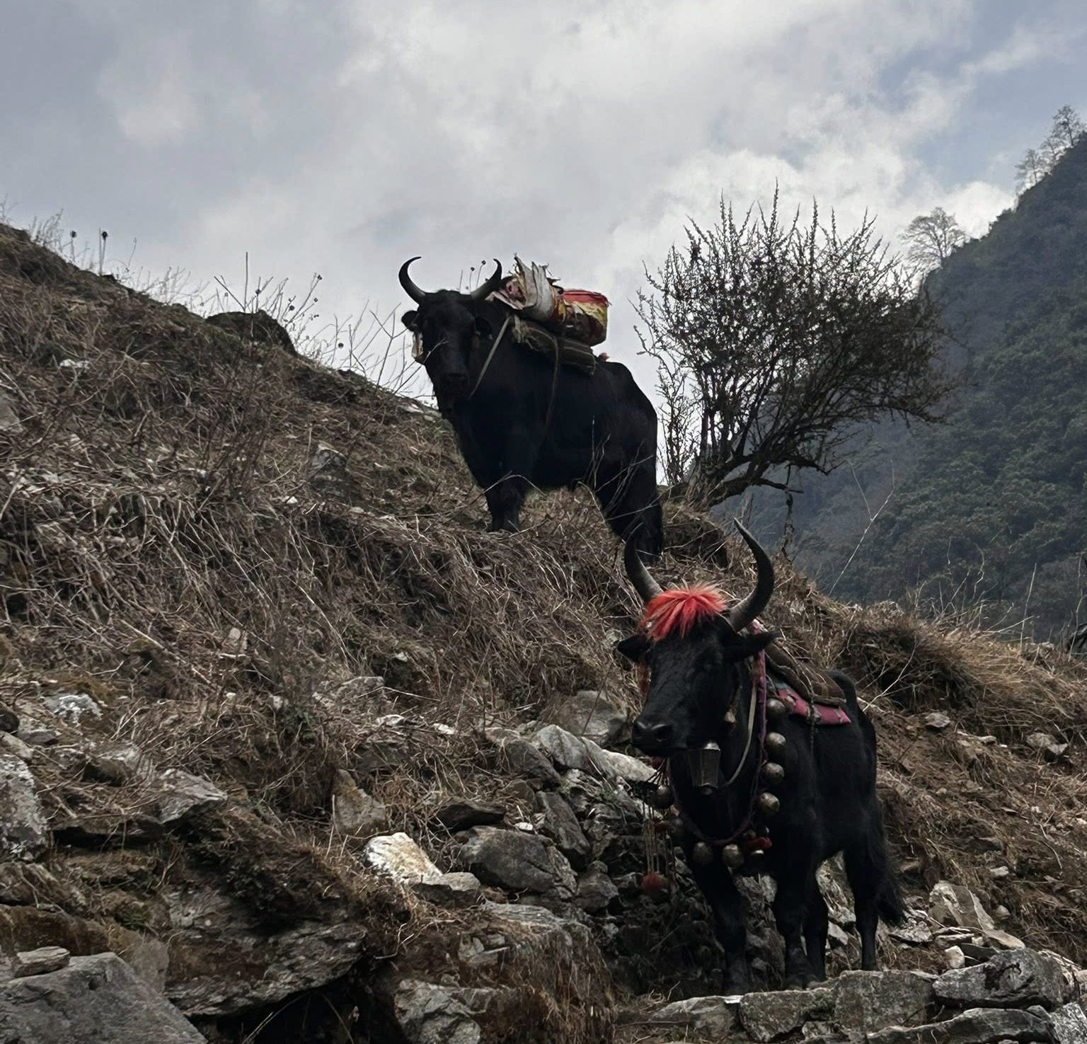
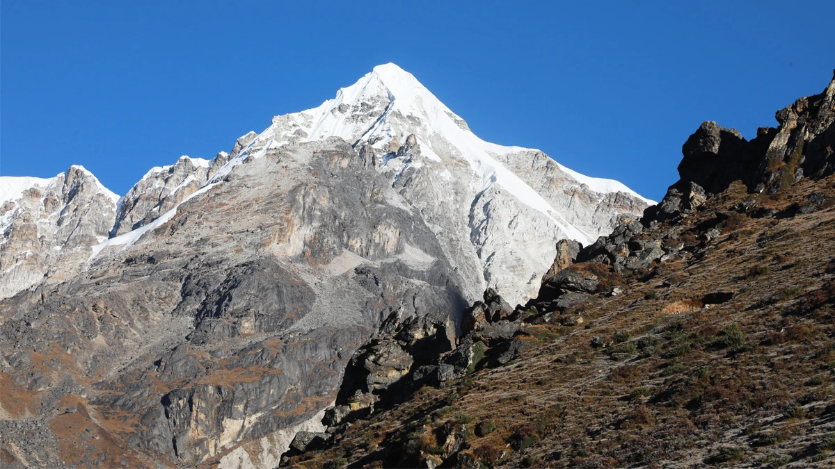
From Ghunsa the trail follows the Ghunsa Khola northeast through increasingly alpine terrain. Pine and rhododendron give way to dwarf juniper and scrub as the elevation rises. The Jannu massif at 7,710m begins to dominate the western skyline from around 3,800m and stays with you until Lhonak. Khambachen is a summer yak pasture village with basic but functional teahouses and exactly the right acclimatisation stage before the push to Lhonak.
Acclimatisation Day at Khambachen
The more important of the two acclimatisation days. The standard excursion climbs to Jannu Base Camp at approximately 4,420m, a 4 to 5 hour round trip with close views of Jannu’s south face and 370m of climbing above camp. The alternative is Nupchu Pokhari, a glacial lake at roughly the same elevation. Both provide the climb-high-sleep-low stimulus that reduces AMS risk on the Lhonak and Pangpema days. Do not skip this day. A single night at Khambachen without the excursion significantly increases AMS risk above.
Trek to Lhonak
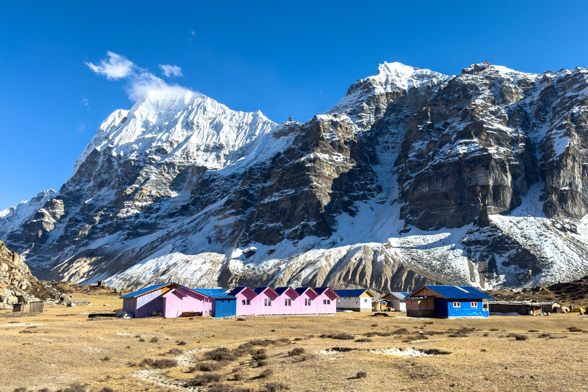
The approach to Lhonak crosses glacial moraines and boulder fields following the lateral moraine of the Kanchenjunga Glacier. The terrain is stark and increasingly barren as yak pasture gives way to rock and glacier debris. Blue sheep are commonly sighted on the moraine slopes. The views of Kanchenjunga’s north face grow steadily as the valley narrows. Expect sub-zero temperatures tonight. Your sleeping bag earns its place from here.
Day Trip to Pangpema North Base Camp
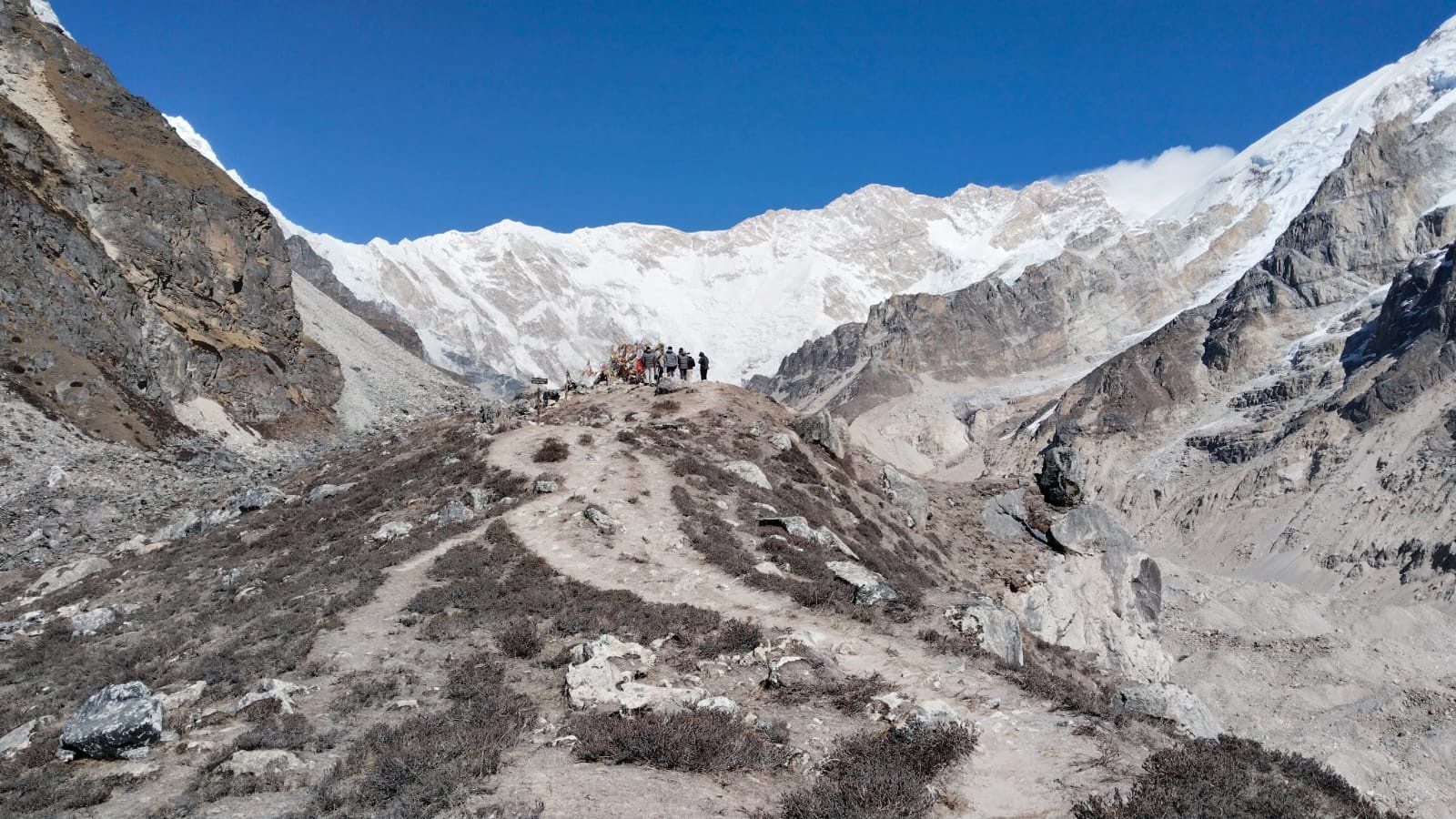
An early start at 5:30am for the 4 to 5 hour climb to Pangpema along the right bank of the Kanchenjunga Glacier. The trail crosses moraine and rocky terrain with no technical sections but the altitude requires careful pacing. Pangpema delivers a 270-degree panorama of Kanchenjunga at 8,586m, Kangbachen at 7,903m, Kirat Chuli at 7,365m and the Gimmigela Twins. Carry a packed lunch regardless of the seasonal teahouse. Return to Lhonak for the overnight.
Descent to Ghunsa
A long descent day dropping 1,185m from Lhonak through Khambachen to Ghunsa. The 15km is physically manageable but requires attention on the rocky moraine sections. Trekking poles are essential. The descent provides a clear view of how dramatically the landscape changes with altitude from barren glacier zone to the relatively lush pine forests around Ghunsa. The village feels genuinely hospitable after three nights above 4,000m.
Trek to Sele La High Camp
Leaving Ghunsa for the last time the trail climbs steeply south through rhododendron and juniper forest toward the Sele La ridge system. Carry a packed lunch and fill all water bottles before leaving Ghunsa. There are no reliable water sources between the high camp and Tseram on the south side tomorrow. The high camp at 4,200m is basic, cold and exposed. Arrive, eat well and sleep early. Tomorrow is the hardest day on the circuit.
Cross the Sele La System to Tseram
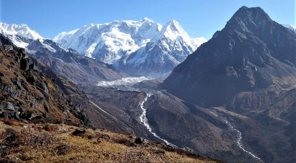
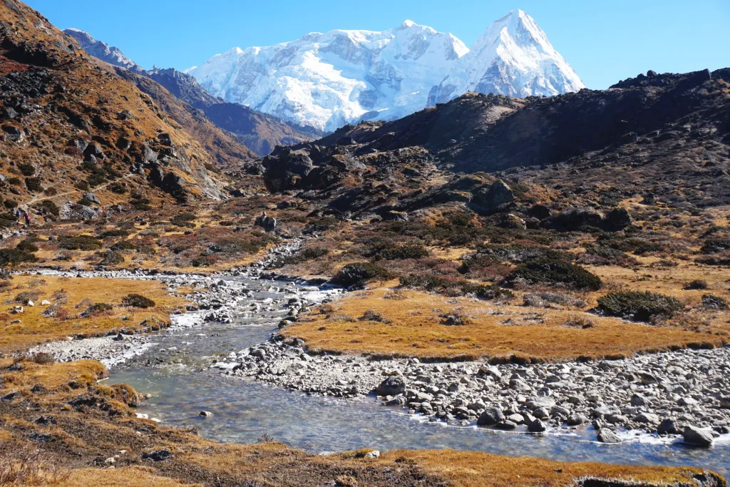
The hardest day on the circuit. The Sele La traverse crosses four passes in sequence: Tamo La at 3,900m, an unnamed pass at 4,115m, Mirgin La at 4,663m and Sinion La at 4,660m. There are no teahouses between the high camp and Tseram. Views from the passes encompass Kanchenjunga, Jannu, Makalu and on clear days Everest. Carry packed lunch and full water from camp. Early departure is essential. Allow the full 10 hours and do not rush the descents.
Trek to Ramche
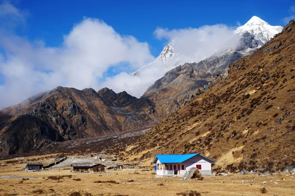
A shorter but significant climb from Tseram northeast up the Yalung valley to Ramche. The trail follows the Yalung Glacier’s southern moraine through yak pasture before the final ascent. The Kanchenjunga massif becomes increasingly visible as elevation increases and the southern face profile is completely different from what was seen at Pangpema. Ramche has basic teahouse accommodation and serves as the base for the Oktang viewpoint hike tomorrow.
Hike to Oktang South Base Camp
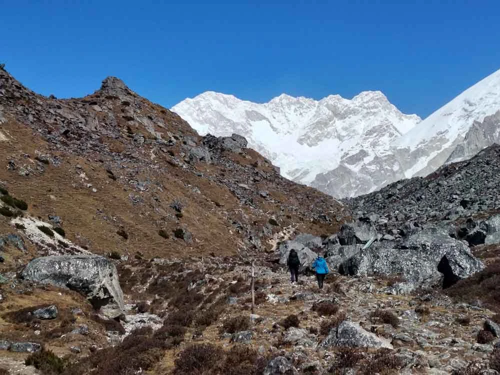
An early start from Ramche for the 4 to 5 hour return hike to Oktang across moraine and glacial terrain. For many trekkers this is the more striking of the two viewpoints. Four Kanchenjunga summits are visible simultaneously: Main at 8,586m, Yalung Kang at 8,505m, Central at 8,482m and South at 8,476m. Kabru at 7,412m, Rathong at 6,678m and Jannu at 7,710m complete the panorama. Return to Ramche for the overnight rather than pushing to Tseram today.
Descend to Tseram
A short recovery day after back-to-back hard days on the south circuit. The descent from Ramche drops 710m over 5km and is finished by late morning. Use the afternoon to rest, dry gear, eat properly and let legs recover before the long descent to Yamphudin begins. Tseram has the most comfortable teahouses on the south leg. After the Oktang hike and several days above 4,000m the slower pace here is not optional.
Descent to Tortong
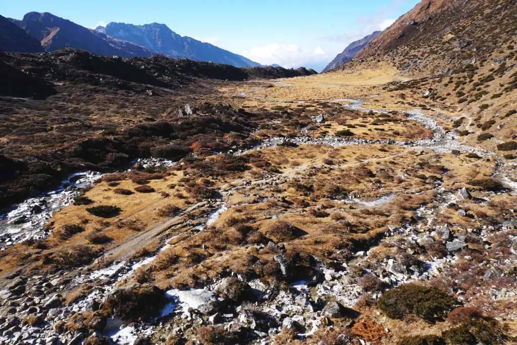
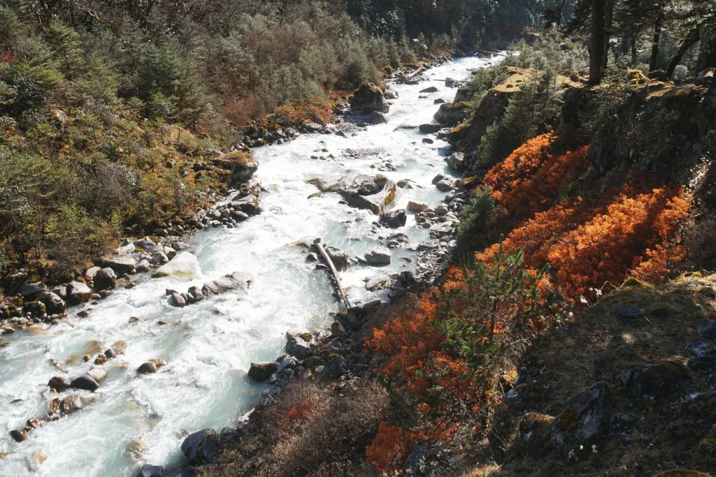
The long descent south begins in earnest. From Tseram the trail drops 875m over 12km through the lower Yalung valley and the landscape changes fast. Alpine scrub gives way to rhododendron, then mixed oak and pine, then dense subtropical forest by the time Tortong comes into view. After more than a week above 4,000m the smell of the forest and warmth of lower elevation feel disorienting in the best way. Fresh vegetables start appearing on the menu again at Tortong.
Descent to Yamphudin
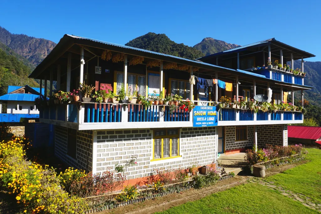
A steady descent through traditional Rai and Limbu villages losing 1,305m over 12km. The cultural shift is immediate from the Tibetan Buddhist north to the Kirat and Hindu-influenced south, with different architecture, language and way of life in each village. Allow time in Mamankhe if the trail is moving well as it is one of the more intact traditional Limbu villages on the south exit. The farewell dinner with your guide and porter team happens here tonight.
Drive to Bhadrapur, Fly to Kathmandu
Leave Yamphudin by 5:30am at the latest. The drive to Bhadrapur takes 6 to 7 hours and Bhadrapur flights to Kathmandu run on a fixed afternoon schedule. Missing the flight means an overnight in Bhadrapur so the early start is non-negotiable. MountainKick books the late afternoon departure specifically to give the drive enough margin. Arrive Kathmandu by early evening. Do not book an international connection for the morning of Day 21.

Departure from Kathmandu
Your guide transfers you to Tribhuvan International Airport for your onward flight. Allow 3 hours before international departure. Twenty one days, two base camps, four passes and the most remote circuit in Nepal. Build at least one buffer day before flying home as Bhadrapur flights occasionally delay and push everything back by a day. Safe travels.
3D Route Map
Includes & Excludes
-
Airport and hotel transfers Private vehicle throughout, all Kathmandu pickups and drop-offs
-
3-star hotel in Kathmandu, twin-sharing with breakfast 2 nights on arrival and return
-
Standard hotel in Taplejung on twin-sharing basis Clean basic guesthouse, last proper hotel before Kathmandu on return
-
Domestic flights Kathmandu to Bhadrapur and return Round trip tickets included, both directions
-
Teahouse accommodation on trek Twin-sharing, 17 nights across the full circuit
-
Licensed guide for the full 21 days NTB-certified, English speaking, experienced on this restricted route. Assistant guide provided for groups of 8 or more.
-
All meals during the trek Breakfast, lunch and dinner at teahouses throughout all 17 trekking days
-
Porter service 1 porter per 2 trekkers, 20kg load limit, full medical insurance
-
All private 4WD ground transport Bhadrapur to Taplejung to Sekathum outbound, Yamphudin to Bhadrapur return
-
Kanchenjunga Conservation Area Permit (KCAP) Arranged in Kathmandu before departure, checked at multiple points
-
Kanchenjunga Restricted Area Permit (RAP) Included in package, no extra charge
-
Farewell dinner in Kathmandu Traditional Nepali food, final evening
-
MountainKick duffel bag Yours to keep
-
Oximeter and first aid kit Carried by guide throughout the trek
-
All government taxes and official fees Nothing added at checkout
-
International flights To and from Kathmandu, booked independently
-
Meals in Kathmandu and Taplejung beyond breakfast Lunch and dinner in Kathmandu and Taplejung are on your own account
-
Nepal visa fee On arrival at Tribhuvan Airport. 15 days $30, 30 days $50, 90 days $125
-
Travel insurance Compulsory. Must cover helicopter evacuation to 5,500m minimum
-
Personal trekking gear Sleeping bag, down jacket, trekking poles — all rentable in Kathmandu
-
Guide and porter tips Customary and appreciated. Roughly 10-15% of trip cost
-
Hot showers and Wi-Fi on trail WiFi available in Taplejung only. Device charging reliable at Ghunsa only above Taplejung. Small extra charge applies.
-
Alcohol and personal drinks Available at teahouses on the lower sections
-
Personal expenses Laundry, calls, souvenirs, snacks
Enhance Your Trek
We Handle the Details — At No Extra Cost
Where You'll Sleep & What You'll Eat
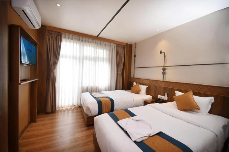
2 nights in Kathmandu: Three-star hotel in Thamel with twin sharing rooms, hot shower, WiFi and daily breakfast included. Same hotel on arrival and return.
1 night in Taplejung: Clean basic guesthouse with private or shared bathrooms, hot water at scheduled times and limited WiFi. The last proper hotel before Kathmandu on the return. Comfortable enough for a good night before the drive to Sekathum.
17 nights on trek: All teahouse accommodation, twin sharing throughout. The pattern is simple: the higher you go the more basic it gets. Below Ghunsa things are functional. Above Ghunsa things are stripped back. At Lhonak and Ramche you are sleeping in the most basic shelters on the route with sub-zero nights guaranteed.
Ghunsa is the best-equipped stop above Taplejung with multiple competing teahouses, micro-hydro electricity and a health post nearby. Charge every device here on both outbound and return nights.
A sleeping bag rated to -15C is mandatory from Khambachen upward. It is not a recommendation.
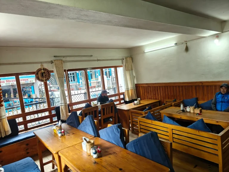
All meals are included throughout the full 17 trekking days. In Kathmandu and Taplejung only breakfast is included. Dal bhat, noodle soups, fried rice, eggs and potatoes available throughout. Fresh vegetables disappear above Khambachen. The farewell dinner in Kathmandu on the final evening is included.
| Meals in Kathmandu and Taplejung | $10 to $20 per meal |
| Hot drinks and water | $4-7 |
| Hot shower and Wi-Fi | $2 to $5 per shower |
| Device charging at Ghunsa | $2 to $4 per device |
| Bottled or filtered water | $1-3 per litre |
What Our Trekkers Say
“An incredible trek in a remote part of Nepal”
We spent an amazing few weeks on the Kanchenjunga Circuit with Furi. The region feels genuinely remote and the mountain scenery is spectacular. He was experienced, calm, and easy to travel with, especially on the longer days -- demanding, but being far from the usual tourist routes made it completely…
“One of the most memorable treks we have done”
Tenzing looked after our group extremely well throughout the Kanchenjunga Circuit. The landscapes were incredible, from forests and remote villages to the huge mountains around the base camps. There were tough days, but he always kept us at a sensible pace. Seeing Kanchenjunga up close is something we'll never forget.
“A real Himalayan adventure”
We chose Kanchenjunga because we wanted something quieter and more challenging, and it was exactly that. Pasang made us feel confident throughout, and the route was beautiful and incredibly varied, with remote valleys, high passes, and amazing mountain views. MountainKick handled the logistics well for such a remote trek --…
Frequently Asked Questions
How difficult is the Kanchenjunga Circuit Trek?
It is one of the hardest teahouse treks in Nepal. The circuit covers roughly 200km over 17 to 18 walking days, crosses four passes on the Sele La traverse and reaches 5,143m at Pangpema. Three days exceed 7 hours on demanding terrain with no road access, no mobile signal and no medical facility above Ghunsa. Any serious emergency means helicopter evacuation. Previous completion of a major Nepal circuit such as Manaslu, Annapurna Circuit or Everest Base Camp without significant AMS is the minimum bar. Check our trek difficulty guide before booking.
What is the difference between Pangpema and Oktang?
Pangpema at 5,143m is the North Base Camp reached from Lhonak. It puts you on the glacial moraine directly below Kanchenjunga’s north face with Jannu dominating the western skyline. Oktang at 4,730m is on the south side reached from Ramche and gives you four Kanchenjunga summits above 8,400m visible simultaneously. They show the same mountain from completely different angles and together are the reason to do the full circuit rather than one side only.
What permits are required and what do they cost?
Two permits are needed: the Kanchenjunga Conservation Area Permit and the Restricted Area Permit. Both are arranged and paid for by MountainKick as part of your package. You do not need to visit any government office yourself. Bring two passport-sized photos and your passport details when you contact us to begin the process. For a full breakdown of permit costs across Nepal read our Nepal Trekking Permits 2026 guide.
Is a licensed guide legally required?
Yes. The Kanchenjunga region is a restricted area and independent trekking is prohibited by Nepalese law. A minimum of two foreign trekkers and a licensed guide are required to obtain the Restricted Area Permit. There is no option to trek solo or without a guide here. MountainKick provides a government-licensed guide as part of every Kanchenjunga package.
What is the best time of year to do this trek?
October is the best single month. Skies are clear, the trail is dry and teahouses are fully stocked. Late September and November also work well. Spring from late March to May is good but afternoon cloud builds faster than in autumn. Avoid June to August entirely. December to February the Sele La passes collect heavy snow and most teahouses above 3,500m close.
What travel insurance do I need?
Your policy must cover helicopter evacuation from a remote area up to at least $15,000. Evacuation from the Kanchenjunga region costs $5,000 to $15,000 and is among the most expensive in Nepal due to distance and remoteness. Standard travel policies often do not cover this. Read yours carefully before purchasing. We ask to see proof of insurance before the trek begins. Read our travel insurance guide for what to look for.
How remote is this trek and what happens in a medical emergency?
There is no road access between Sekathum and Yamphudin. Mobile signal is essentially absent above Taplejung. The only medical facility on the circuit is the health post at Ghunsa. For any serious emergency above Ghunsa the response is helicopter evacuation which takes 2 to 6 hours depending on weather. Your guide carries a pulse oximeter and is trained in AMS recognition. Comprehensive travel insurance covering helicopter evacuation to $15,000 is mandatory and must be confirmed before departure. Read our altitude sickness guide before booking.
How does Kanchenjunga compare to the Manaslu Circuit?
The Manaslu Circuit is 15 days, peaks at 5,106m on Larkya La and has slightly better teahouse infrastructure. Kanchenjunga is longer at 21 days, more remote, requires two restricted area permits and crosses a more complex pass system. Most trekkers do Manaslu first and Kanchenjunga when they are ready for the next level. If you are deciding between the two read our circuit comparison guide.
Should I build buffer days into my travel plans?
Yes and this is important. Bhadrapur flights are occasionally delayed by weather or technical issues. Do not book an international connection for the morning after Day 21. Build at least one extra night in Kathmandu before your departure flight. If the Bhadrapur flight on Day 20 is delayed you will need that buffer. We have seen trekkers miss international flights because they did not plan for this.
Departure Dates & Pricing
No upcoming fixed departures are scheduled at the moment. Contact us to arrange a private departure on dates that suit you.
-
1
20% Deposit — Due on booking Secures your place on the departure. Refundable within cancellation window.
-
2
80% Balance — Due on arrival Pay the remainder in Kathmandu before the trip begins. Bank transfer, card, or cash accepted.
-
3
Bhutan & Tibet — Full payment 20 days prior Full balance required at least 20 days before departure for Bhutan and Tibet tours.
| 30+ days before departure | Deposit forfeited, balance refunded in full |
| 15–29 days before departure | 50% of total trip cost charged |
| Under 15 days | No refund |
| MountainKick cancels trip | Full refund or reschedule |
We give you the power to choose the departure date that suits your group best. A private trip is a perfect solution if you can’t find a published departure date that you and your companions agree on. You can set up a private departure for most of the trips we offer.
Ready to go? Request your preferred dates or message us directly on WhatsApp — we'll confirm availability within a few hours.
We never force our customers to follow our set itinerary. You can customize your itinerary exactly the way you want. Please share with us your ideas.
"*" indicates required fields
Packing List
| Item | Qty | Note |
|---|---|---|
| Waterproof trekking boots | 1 pair | Ankle support, Vibram sole. Break in for at least 50km before departure. New boots on day one will end your trek by day three. |
| Camp sandals or flip-flops | 1 pair | Teahouse evenings and shared bathroom use only. Not for trail. |
| Trekking socks | 6-7 pairs | Merino wool preferred. Hang overnight and they last 2-3 days before washing. |
| Thermal socks | 2 pairs | Essential on the Sele La traverse in all seasons and on the moraine sections above Khambachen. Heavyweight gaiters recommended over lightweight. |
| Gaiters | 1 pair | Useful on Larkya La if snow is present. Lightweight trail gaiters are sufficient in autumn and spring. |
| Leech socks | 1 pair | For the subtropical lower Ghunsa Khola valley sections below Amjilosa, particularly in spring. Pull-on style covering boot tops. |
| Item | Qty | Note |
|---|---|---|
| Moisture-wicking trekking shirts | 3-4 | Merino or synthetic only. No cotton anywhere in your kit. Cotton stays wet and makes you dangerously cold at altitude. Mix of short and long sleeve. |
| Thermal base layer top | 2 | One for trekking days, one clean set for sleeping above 3,500m. |
| Thermal base layer bottom | 2 | Essential from Khambachen upward. Non-negotiable above Lhonak and Ramche. |
| Trekking trousers | 2-3 pairs | Quick-dry. Zip-off useful for the warm humid lower valley sections below Amjilosa. |
| Fleece jacket | 1 | Mid-layer for evenings and cold mornings. Works under the down jacket at altitude. |
| Underwear | 6-7 pairs | Moisture-wicking. |
| Item | Qty | Note |
|---|---|---|
| Down jacket | 1 | Essential from Khambachen upward. Mandatory on Sele La crossing day and at Lhonak and Ramche. Wind chill at the passes can make temperatures feel like -15°C to -20°C. Rentable in Kathmandu. |
| Waterproof hardshell jacket | 1 | Windproof with taped seams and a hood. The lower Ghunsa Khola valley gets rain in spring. The Sele La passes get wind year-round. |
| Waterproof trousers | 1 pair | For rain on the lower trail and wind on the pass. Lightweight enough to stuff in your daypack. |
| Item | Qty | Note |
|---|---|---|
| Sun hat or cap | 1 | The lower gorge sections are humid and exposed. UV radiation increases significantly above 3,000m. |
| Warm beanie | 1 | Essential above 3,500m. Non-negotiable at Lhonak, Ramche and on the Sele La passes. |
| Buff or neck gaiter | 1 | Dust on the lower trail, cold wind on the upper sections. One of the most useful items per gram in your pack. |
| Balaclava | 1 | Pre-dawn start on Sele La crossing day can be -10°C to -20°C with wind. Not optional. |
| Liner gloves | 1 pair | Base layer for hands. Allow normal use of poles and phone. |
| Waterproof outer gloves | 1 pair | Essential on the Sele La traverse and at Lhonak and Ramche regardless of season. |
| UV sunglasses | 1 | Category 3 or 4 lens rating. Glacier and snowfield above Dharamsala makes snow blindness a real risk. |
| Item | Qty | Note |
|---|---|---|
| Trekking poles | 1 pair | The Sele La descent and the return from Lhonak drop over 1,000m on tired legs. Poles reduce knee strain significantly. Rentable in Kathmandu. Not available on trail. |
| Daypack 25-30L | 1 | Your carry for every walking day. Hip belt essential for 17 active trekking days. |
| Headlamp with spare batteries | 1 | Pre-dawn start on Sele La crossing day. Cold temperatures drain batteries fast. Carry spares inside your jacket to keep them warm. |
| Water bottles 1L | 2 | Cold temperatures above 4,000m freeze hydration bladder hoses. Hard bottles only above Khambachen. |
| Water purification tablets or filter | 1 | Critical on Kanchenjunga. Fewer safe water stations than on Annapurna or EBC routes. Carry enough tablets for the full 17 trekking days plus a backup filter. |
| Sleeping bag rated -10°C | 1 | item_name: Sleeping bag rated -15°C item_note: Mandatory from Khambachen upward, not a recommendation. Lhonak and Ramche rooms drop below freezing. Rentable in Kathmandu. |
| Dry bags or ziplock bags | several | Waterproof everything inside the duffel. The gorge sections get rain. No exceptions for electronics and documents. |
| Small padlock | 1 | For the duffel during hotel stays. |
| Pack rain cover | 1 | For both duffel and daypack. |
| Shoe repair glue | 1 small tube | No repair options above Ghunsa. A detached sole above Khambachen is a serious problem. |
| Item | Qty | Note |
|---|---|---|
| Diamox (Acetazolamide) | as prescribed | Discuss with your doctor before departure. Common dose 125mg twice daily from Khambachen upward. Aids acclimatisation but is not a substitute for proper pacing. |
| Ibuprofen | sufficient supply | For headaches and muscle pain. Do not use to mask AMS symptoms. |
| Rehydration salts | 8-10 sachets | High altitude dehydrates faster than most trekkers expect. Drink 4-5 litres of water per day above 3,500m. |
| Blister kit | 1 | Moleskin, compeed, medical tape, needle. Deal with hot spots at the first sign. |
| Antiseptic cream and plasters | 1 small kit | Rocky trail sections in the gorge cause minor cuts. |
| Throat lozenges | 1-2 packs | Dry high-altitude air causes a persistent cough above Ghunsa. Very common and very annoying. |
| Stomach medication | Immodium and antacids | Teahouse food hygiene standards vary on the lower trail. Carry and use. |
| Personal medications | full supply plus 5 days extra | The nearest pharmacy is in Kathmandu. There are no medical resupply options on the circuit. |
| Hand sanitiser | 2 bottles | 2 bottles |
| Sunscreen SPF 50+ | 1 | UV radiation at 5,160m is intense. Reapply every 2 hours on exposed days. |
| Lip balm with SPF | 1 | Wind and cold at altitude cracks lips fast. |
| Item | Qty | Note |
|---|---|---|
| Passport | 1 original | Keep in a waterproof bag in your daypack. Permits are checked at multiple checkpoints from Sekathum onward. |
| Permit photocopies | 3 sets | Your guide carries originals. You carry photocopies. Digital copies have been rejected at remote checkpoints with no internet. |
| Travel insurance documents | printed copy | Must show helicopter rescue coverage to $15,000 and restricted area trekking. Emergency number written separately. |
| Nepali Rupees cash | full trail budget | No ATMs beyond Kathmandu. The Taplejung ATM is unreliable. Budget NPR equivalent of $700 to $900 for the full circuit covering tips, showers, charging and snacks. Carry small denominations as teahouses above Ghunsa cannot break large notes. |
| Passport photos | 4-6 copies | For permits and any checkpoint registration. |
| Emergency contact list | written on paper | Phone batteries die. Paper does not. |
| Item | Qty | Note |
|---|---|---|
| Phone in waterproof case | 1 | Download offline maps (Maps.me or Gaia GPS) before leaving Kathmandu. Signal is essentially absent above Taplejung for most of the circuit. |
| Power bank 20,000mAh minimum | 1 | Charging at teahouses costs NPR 300-500 per device and is reliable only at Ghunsa. Above Ghunsa there is no reliable electricity. A large power bank is essential on this route, not a luxury. |
| Camera with spare batteries | 1 | Cold drains batteries 2-3x faster. Keep spares in an inner jacket pocket. |
| Universal adapter | 1 | Nepal uses Type C, D, and M plugs. Charge everything fully in Kathmandu before the jeep departs. |
| Satellite communicator (optional) | 1 | Garmin inReach or equivalent. Recommended for solo trekkers. Provides two-way messaging and SOS where mobile signal does not exist. Rentable in Kathmandu for $10-15 per day. |
| Item | Note |
|---|---|
| Heavyweight down jacket | Standard down is not enough in January at Lhonak or Ramche. Upgrade to higher fill-power or double-layer jacket. |
| Insulated trekking boots | Standard waterproof boots become inadequate below -15°C. Temperatures at Lhonak and Ramche can drop to -20°C in January. |
| Microspikes or crampons | The Sele La passes have hard ice and compacted snow in winter. Non-negotiable for safe crossing. |
| Extra thermal layers | Add one more base layer top and bottom. Teahouse rooms above 4,000m can drop below freezing overnight. |
| Heavy-duty gaiters | Deep snow on the approach to and descent from the Sele La passes in winter. |
| Hand and toe warmers | Single-use chemical warmers for the crossing day. Pre-dawn temperatures at the pass hit -20°C or below in winter. |
| Check teahouse availability | Some teahouses above Ghunsa close in deep winter (January-February). Confirm with us before booking a winter departure. |
| Item | Note |
|---|---|
| High-quality rain poncho | The lower Ghunsa Khola valley gets heavy sustained rain in monsoon. A hardshell alone is not enough for prolonged wet days. |
| Double quantity of socks | Socks will not dry overnight in monsoon humidity. Bring twice as many. |
| Leech socks (essential, not optional) | Monsoon leeches in the subtropical lower valley sections below Amjilosa are aggressive. Pull-on leech socks covering boot tops are non-negotiable Jun-Aug. |
| Dry bags (double quantity) | Everything gets wet. Double-bag electronics, documents, and dry clothes without exception. |
| Microspikes | The Sele La passes can have fresh snow after monsoon storms. Conditions can change overnight. |
Sleeping bags, down jackets, and trekking poles are all available to rent in Thamel, Kathmandu. We walk you to reliable shops at the pre-trek briefing the evening before the Bhadrapur flight. MountainKick provides a duffel bag for every trekker as part of the package. Nothing is available to rent on the Kanchenjunga Circuit itself. If you need it, get it in Kathmandu.
What Not to Bring
Kanchenjunga Circuit Trek
Kumar and the team have guided this route for over a decade. Ask anything — gear, fitness, altitude, private groups — before you commit.


Tales from the Himalayas
Fresh stories and expert insights from our mountain adventures
Best Treks in Nepal for Beginners: How to Choose Your First Trek
You don't need experience to trek in Nepal, but you do need the right first trek. Here's how to choose one by fitness, altitude and time, with our real prices and routes.
Poon Hill vs Mardi Himal vs Annapurna Base Camp: Which Annapurna Trek Should You Choose?
Three of the most popular treks from Pokhara, but they ask very different things of you. Here's how Poon Hill, Mardi Himal and ABC compare on days, altitude, cost and views.

Annapurna Region, Everest Region, Essentials
Everest Base Camp vs Annapurna Base Camp: Which Trek Should You Choose?
Both take about two weeks, but they suit very different trekkers. Here's how to decide.