
Trek Nepal's largest lake via Jumla, the ancient Khasa Kingdom capital at Sinja Valley and three mountain passes on a 15-day circuit with two full days at the water.


Two Full Days at Rara Lake
12th to 14th century Khasa Malla Kingdom capital directly on the trail route
Jaljala at 3,580m, Ghurchi Lagna at 3,480m and Danphe Lagna at 3,691m on the return
Only Rara National Park permit and TIMS required, both handled before departure
The Rara Lake Trek is a 15-day teahouse circuit from Jumla through three mountain passes, the ancient Khasa Malla capital of Sinja Valley and two full days at Nepal’s largest freshwater lake. You fly Kathmandu to Nepalgunj then a 30-minute Twin Otter to Jumla at 2,370m, walk 10 days through terrain that receives a fraction of Everest or Annapurna traffic, spend two nights at Rara Lake, and fly back the same way. The maximum altitude is 3,691m at Danphe Lagna Pass on Day 12, substantially lower than the Everest or Manaslu circuits, but three consecutive pass crossings on tired legs and the remoteness of the Mugu District trail make this a genuinely demanding circuit.
The Sinja Valley detour on Day 5 is not a side trip. It sits directly on the trail between Jaljala Pass and Ghorosingha. Sinja was the capital of the Khasa Malla Kingdom from roughly the 12th to 14th centuries, a dynasty that controlled much of western Nepal, parts of Tibet and northern India. The ruins of the old palace are visible from the trail across the Sinja Khola river. Cambridge University’s archaeology department has conducted excavations here. The valley is also cited as the birthplace of the Khas language, the direct ancestor of modern Nepali. Most trekkers describe it as the most historically significant stop of the entire route.
Two full days at Rara Lake are built into the itinerary. The first for the optional Chuchemara Hill hike to 4,090m, which gives an aerial view of the full 10.8 sq km lake. The second as both a rest day and a weather buffer. Morning cloud is common at Rara and one poor weather day does not cost you the best views. The farewell night is in Jumla before the return flights. Day 14 in Kathmandu is a built-in buffer for Jumla flight delays, which are common. Do not book an international departure on Day 15 without at least one extra night in Kathmandu as a margin. Read our Altitude Sickness guide and Travel Insurance guide before booking.
Your guide meets you at Tribhuvan Airport and transfers you to your hotel in Thamel. The evening briefing covers the full 15-day circuit, gear check, permit documents and the Jumla flight logistics for Days 2 and 3. Jumla flights connect through Nepalgunj and are weather dependent so your guide will review the current forecast and contingency plan tonight. Withdraw all cash in Kathmandu as ATMs in Jumla are unreliable and there are no banking facilities from Day 4 onward.

A one-hour scheduled flight to Nepalgunj, the main hub of western Nepal’s Terai belt. Nepalgunj sits at 150m and is warm, humid and noticeably different from Kathmandu in culture and feel with a mix of Nepali, Tharu and Muslim communities visible in the bazaar. The afternoon is free to visit Bageshwori Temple or the India border market a 20-minute walk away. Charge every device fully tonight as reliable electricity ends here for most of the circuit.

An early 30-minute Twin Otter flight to Jumla at 2,370m, the highest airport in Nepal on regular scheduled service. Stock up on snacks at Jumla’s Khalanga Bazaar before the trail begins as options become very limited beyond this point. The trek climbs immediately from the airport through terraced fields and pine forest along the Jugad Khola gaining 685m to the broad highland plateau of Chere Chaur. The ascent is the first serious effort of the circuit and sets the tone for the days ahead.
The first major high point of the circuit. The trail climbs west from Chere Chaur through dense rhododendron, birch and pine forest before emerging onto open ridge at Jaljala Pass at 3,580m. The Kanjiroba Himal range with its highest peak at 6,883m is visible to the north on clear mornings. The descent drops to the wide grassland of Jaljala Chaur at 3,420m where the circuit trail officially begins and the return route via Danphe Lagna forks right. A long descent through forest follows into the Jaljala Khola valley to Chalachaur.
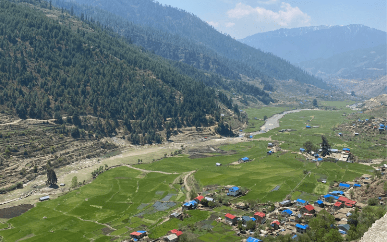
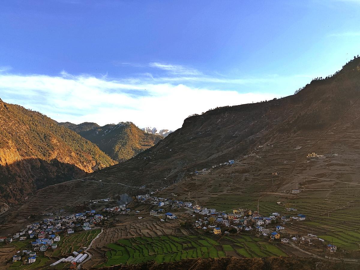
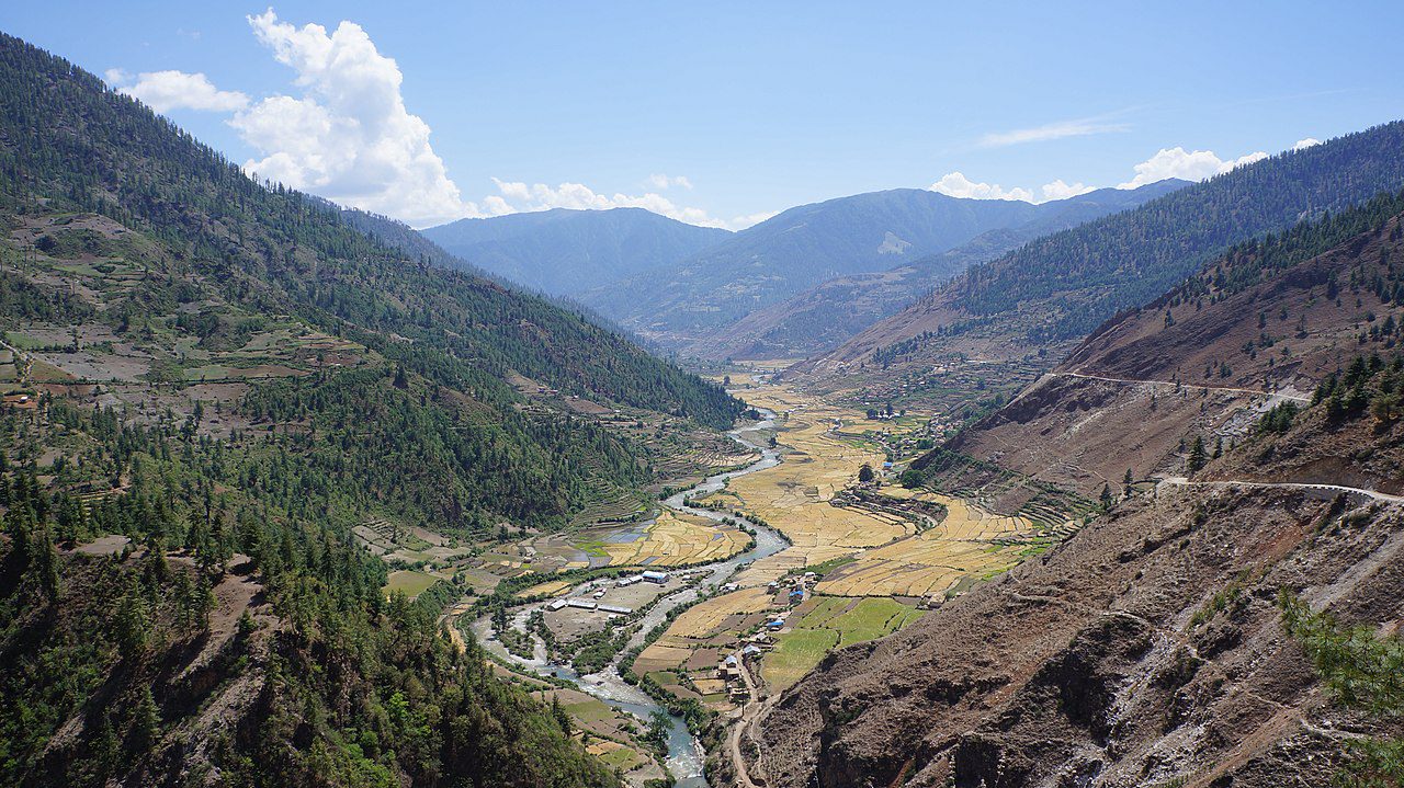
The trail follows the Jaljala Khola downstream through traditional villages crossing the river on log and suspension bridges and passing stone fields etched with Malla dynasty inscriptions. Kanaksundari village has a 300-year-old Bhagwati temple directly on the trail worth a short stop. Sinja Valley opens at the end of the day, a flat river plain at 2,490m that served as the capital of the Khasa Malla Kingdom from the 12th to 14th centuries. The ruins of the old palace are visible from the trail across the Sinja Khola. Cambridge University has conducted archaeological excavations here and the valley is cited as the birthplace of the Khas language, the direct ancestor of modern Nepali.

Leaving Sinja the trail climbs east following the Hima River through pine and birch forest before a steep ascent to Laha village, a good lunch stop with basic teahouse facilities. The afternoon continues through Gani settlement before the final push to Ghorosingha at 3,050m on a high ridge with views of the surrounding hills. This is the last significant stop before the approach to Rara begins tomorrow. A sleeping bag rated to -5C minimum is essential from tonight as temperatures drop noticeably at this elevation.
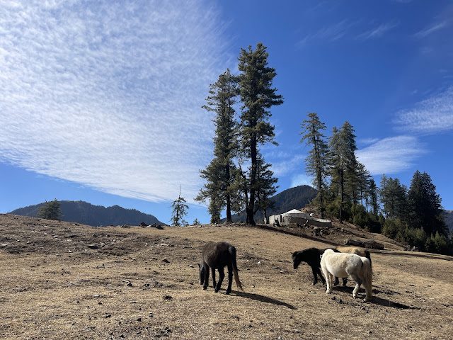
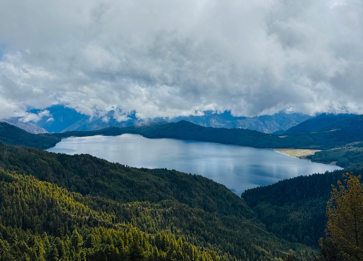
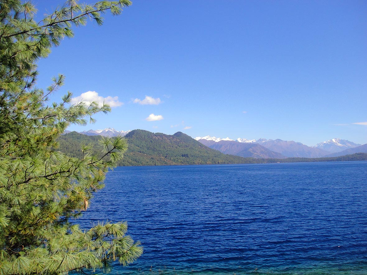
The approach to Rara climbs steeply through cedar and pine forest via the Chuchemara Danda ridge where the lake first appears through the trees around 3 to 4 hours into the day. Most trekkers stop here longer than planned. The descent via Murma village leads to the lake shore and Chhapri, the Rara National Park headquarters. Rara at 2,990m covers 10.8 sq km and the water shifts between deep blue and green depending on cloud and light. After six days on trail the teahouses here feel genuinely luxurious by comparison.

A full day with no fixed route. The main excursion is the hike to Chuchemara Hill at 4,090m, a 3 to 4 hour round trip on a steep but straightforward trail delivering an aerial view of the full 10.8 sq km lake with the Kanjiroba and Saipal Himal ranges as backdrop. A complete shoreline walk takes 3 to 4 hours at a relaxed pace through forest, meadow and rocky outcrops. Boat rides on the lake can be arranged locally. Wildlife active at the forest edge in early morning includes musk deer, Himalayan monal and in rare cases red panda.
A second full day at the lake built in for two reasons. Morning cloud is common at Rara and a poor weather window on Day 8 does not cost you the best views. The second day also functions as genuine rest after six consecutive days of trail before the return circuit begins. Revisit Chuchemara at a different time of day for different light on the water, walk sections of shore missed yesterday, or simply sit by the lake. Wildlife observation is most productive at the forest edge in the first hour after sunrise and in the hour before dark.
The return begins. The trail heads west from the lake descending to Gamgadhi at 2,100m, the administrative headquarters of Mugu District with a small bazaar and government offices. Stock up on any supplies here as options become limited south of Gamgadhi. From Gamgadhi the trail follows the Jhyari Khola south through pine and cedar forest passing through traditional Magar villages to Pina at 2,440m. One of the easier days on the circuit by distance and terrain, useful for legs that have now covered over 80km from Jumla.
The return circuit’s first serious day. The trail climbs south through forest to Bhulbule at 3,130m, the Rara National Park exit checkpoint where permits are verified for the last time. The ascent continues to Ghurchi Lagna Pass at 3,480m marked with chortens and prayer flags with views of the Karnali River valley far below and snow peaks bordering Tibet to the north. A long descent through spruce forest drops to Bumra at 2,850m. Cold nights are guaranteed at this elevation and the sleeping bag earns its place again tonight.
The hardest day on the return and the highest point of the entire circuit. The trail crosses two suspension bridges over the Hima River then climbs an unrelenting gradient through birch forest to the natural hot springs, a well-earned rest stop before the final push. The hot springs sit roughly 1.5 to 2 hours below Danphe Lagna Pass at 3,691m, named for the danphe Himalayan monal that frequents the surrounding forest. From the pass the descent drops to Chere Chaur rejoining the Day 3 approach trail and continues into Jumla. The final stretch from Chere Chaur to Jumla takes 2 to 3 hours on a well-worn path.

The morning Twin Otter from Jumla to Nepalgunj takes 30 minutes and follows a scenic low-level route over the Karnali highlands. Cloud typically builds over Jumla by mid-morning so the early slot is critical. MountainKick books the earliest available departure. The connection to Kathmandu takes one hour with arrival by early to mid afternoon. MountainKick arranges a farewell dinner this evening with a traditional Nepali meal. Do not book an international departure tomorrow as Day 14 is your flight delay buffer.

A built-in buffer day for Jumla flight delays, which are common on the Twin Otter route. If flights ran on schedule this is free time in Kathmandu. Boudhanath Stupa is a 20-minute taxi from Thamel and worth the visit. Bhaktapur Durbar Square is 45 minutes by road and one of the best-preserved medieval cities in Asia. Pashupatinath Temple is 30 minutes from Thamel. Use the afternoon for last-minute shopping in Thamel or simply rest before tomorrow’s international departure.

Your guide transfers you to Tribhuvan International Airport approximately 3 hours before your international departure. If your flight departs late the morning is free for a final walk through Thamel. Fifteen days, three mountain passes, the ancient ruins of Sinja Valley and two full days at Nepal’s largest lake. Safe travels.


2 nights in Kathmandu: Three-star hotel in Thamel with twin sharing rooms, hot shower, WiFi and daily breakfast included. Same hotel on arrival, return and buffer day.
2 nights in Nepalgunj: Air-conditioned hotel near the domestic airport with private bathrooms and hot water. Air conditioning is essential as Nepalgunj reaches 35C in spring and summer. Breakfast included both nights.
11 nights on trek (Chere Chaur to Jumla return): All teahouse accommodation, twin sharing throughout. Teahouse quality follows a clear pattern: Jumla and Sinja Valley are the most comfortable stops on the circuit. Ghorosingha, Chere Chaur and Bumra are the most basic with cold nights, shared squat bathrooms and no hot water. Rara Lake has the best teahouses on the trail with some lodges offering partial lake views from the windows.
Bring a sleeping bag rated to -10C. Blankets are provided at all teahouses but rooms above 3,000m get genuinely cold year-round. Single rooms become difficult to find above Sinja Valley.

All meals included throughout the trek from Day 3 to Day 12. Breakfast is included at Kathmandu and Nepalgunj hotels. The farewell dinner on Day 13 is included.
Dal bhat is the most reliable and nutritious option throughout the circuit. Fried rice, noodle soup, eggs, chapati and porridge are available at all stops. Vegetarian options are consistent. Meat quality becomes less reliable above 2,500m. Fresh vegetables disappear above Ghorosingha. The Rara Lake teahouses are the best provisioned on the full circuit.
| Meals in Kathmandu and Nepalgunj | $10 to $20 per meal |
| Hot drinks and water | $4-7 |
| Hot shower and Wi-Fi | $3-6 |
| Bottled or filtered water | $1-3 per litre |
| Boat rides at Rara Lake | $5 to $10 per person |
“I’m already planning for the trip AGAIN and you would know which company I’d choose AGAIN…”
Finally, I had the opportunity to meander across the splendor of the Himalayas. My first concern after researching everything there was to know about Nepal was my safety and my child’s welfare. But upon our arrival at the airport, I found out that Kathmandu is one of the meanest places…
“MountainKick is haven for trekkers and one cannot afford to miss it if you are interested in trekking in Nepal.”
To whoever reading this and wondering about the legitimacy of this company, they are for real. The team is genuinely dedicated to making your trekking memorable and rewarding. Such is the professionalism of the company that they went steps further to assist us that included the tracking down of the…
“We liked the concern of this company for its staffs and the environmental awareness and it has.”
There was always a response from Jagat as we had so many things to ask. We had insisted on having a Nepali guide instead of a westerner because we had to make sure the money we spend actually goes to Nepali people. We chose this company because we had heard…
“We had the trip of our lifetime”
We had the trip of our lifetime thanks to the warm hospitality bestowed upon us and the beauty of such amazing country. From well-organized trips, exotic locations, cultural sightseeing to the thrill of safari, “soft” trekking to Poon Hill, everything was memorable. Our trekking guide was Shiva, apparently named after…
We rate this Hard. Daily hiking averages 5 to 7 hours with three days at the harder end. Days 4, 11 and 12 each involve 6 to 8 hours of walking with significant elevation change crossing passes above 3,400m. The maximum altitude at Danphe Lagna Pass is 3,691m, moderate by Nepal standards, but three passes are crossed consecutively with no acclimatisation day and the terrain between them is rough with minimal trail marking. Good cardiovascular fitness and strong knees for sustained descents matter more than extreme altitude tolerance on this route. Read our trek difficulty guide before booking.
October is the single best month. Skies are clear, the trail is dry and teahouses are fully stocked. Late September and November work well. Spring from March to May brings rhododendron bloom through the forest sections between Jumla and Jaljala Pass and on the approaches to Ghurchi Lagna and Danphe Lagna. Monsoon from June to August is possible but brings heavy rain, leeches in the lower forest sections and significantly higher risk of Jumla flight disruption. December to February the three passes above 3,400m require serious cold weather gear and high cold tolerance overnight.
Three domestic flights connect this circuit: Kathmandu to Nepalgunj (1 hour, reliable scheduled service), Nepalgunj to Jumla (30 minutes, Twin Otter, weather dependent) and Jumla to Nepalgunj on return (same aircraft). The Nepalgunj to Jumla leg is the most weather sensitive. Morning cloud at Jumla, which sits at 2,370m in a valley, can cancel or delay the flight by 1 to 2 days. MountainKick books morning departure slots and Day 14 is built into the itinerary specifically as a buffer. Plan your international departure with at least a 2-day gap after Day 13. For context on mountain flight variability read our Lukla Flight Delays guide.
Two permits are required: the Rara National Park entry permit and a TIMS card. MountainKick arranges and covers both as part of the package. This is not a restricted area trek so no special restricted area permit is needed unlike Tsum Valley or Upper Mustang. Permits are checked at the Bhulbule National Park entrance station on Day 11. Bring two passport-sized photos and your passport details when you contact us to begin the process. For a full breakdown of Nepal permit costs read our Nepal Trekking Permits 2026 guide.
Sinja Valley is not a detour. It sits directly on the main circuit trail between Jaljala Pass and Ghorosingha on Day 5. The valley was the capital of the Khasa Malla Kingdom from roughly the 12th to 14th centuries, a dynasty that controlled much of western Nepal, parts of Tibet and northern India. The ruins of the old palace are visible from the trail across the Sinja Khola river. A 300-year-old Bhagwati temple still stands in the valley. Cambridge University’s archaeology department has conducted excavations here. Sinja is also cited as the birthplace of the Khas language, the direct ancestor of modern Nepali. It is the most historically significant stop on the entire circuit and takes less than half a day to pass through at trekking pace.
Day 8 is the primary exploration day including the optional hike to Chuchemara Hill at 4,090m, the lake shoreline walk and boat rides. Day 9 serves two purposes: genuine rest after six consecutive days on trail before the return circuit begins, and a weather buffer. Morning cloud is common at Rara and one poor weather window on Day 8 should not cost you the best lake views. The Chuchemara Hill hike on a clear morning is the single best viewpoint for seeing the full 10.8 sq km of the lake at once. Most trekkers describe the second day as earning its place.
Chuchemara Hill at 4,090m rises above the Rara Lake shore and is the best elevated viewpoint for seeing the entire lake at once. The hike from lake level to the summit is 3 to 4 hours round trip on a steep but straightforward trail. From the top the full 10.8 sq km of the lake is visible surrounded by the dense pine and cedar forests of Rara National Park with the Kanjiroba and Saipal Himal ranges in the background. Do it on Day 8 if the weather is clear. Day 9 exists partly so a cloudy Day 8 does not cost you the view.
Your policy must cover trekking to at least 4,200m covering the Chuchemara Hill day hike and emergency helicopter evacuation from the Jumla region. Estimated evacuation cost is USD 2,500 to 5,000. Standard policies often exclude far western Nepal so check the fine print carefully before purchasing. We require policy documentation before the trek begins. Read our travel insurance guide for what to look for in a policy covering remote Nepal trekking.
Rara National Park records over 200 bird species. The most frequently seen include the Himalayan monal, Nepal’s national bird, blood pheasant, koklass pheasant and multiple migratory waterfowl species at the lake. Mammals present include Himalayan black bear, musk deer, red panda, goral, grey wolf and common leopard. Musk deer are occasionally seen at the forest edge around the lake in the early morning and late afternoon. Red panda are present but sightings are uncommon. The Danphe Lagna Pass area named for the danphe or Himalayan monal is the most reliable birdwatching location on the return route.
Withdraw everything in Kathmandu before departure. Jumla’s Khalanga Bazaar has ATMs but they are not reliably stocked so treat them as a supplement not a primary source. There are no banking facilities from Day 4 onward. Budget NPR equivalent of USD 350 to 500 for the 10 trekking days covering hot showers, WiFi, device charging, snacks and a buffer for an unexpected Jumla delay night. Carry small denominations as change is difficult at high elevation teahouses.
The most significant hot springs sit below Danphe Lagna Pass on Day 12 approximately 1.5 to 2 hours below the pass on the descent toward Chere Chaur. The thermal pool is a traditional bathing spot for local people and trekkers. The water temperature varies but is reliably warm enough for a soak. After 10 days on trail and a steep morning climb to the highest point of the circuit most trekkers describe the hot springs as one of the more memorable stops on the return route.
The Rara Lake Trek is the most accessible far western Nepal option in MountainKick’s portfolio. It is shorter than the Khaptad to Rara via Badimalika Trek at 18 days, less logistically complex than the Lower Dolpo Trek at 19 days, and lower in maximum altitude than Upper Dolpo. The 15-day Rara circuit is the right entry point for trekkers who want genuine far western Nepal remoteness without extended camping sections and higher logistics complexity of the longer circuits.
Yes. The Khaptad to Rara via Badimalika Trek is MountainKick’s 18-day circuit that combines Khaptad National Park, Badimalika Temple at 4,210m and Rara Lake into one connected expedition entering via Dhangadhi and exiting via Talcha Airport near the lake. For Dolpo, the Lower Dolpo Trek is a separate expedition that can be considered as a western Nepal extension in the same travel period. Contact Kumar for multi-region itinerary options and pricing.
No upcoming fixed departures are scheduled at the moment. Contact us to arrange a private departure on dates that suit you.
| 30+ days before departure | Deposit forfeited, balance refunded in full |
| 15–29 days before departure | 50% of total trip cost charged |
| Under 15 days | No refund |
| MountainKick cancels trip | Full refund or reschedule |
We never force our customers to follow our set itinerary. You can customize your itinerary exactly the way you want. Please share with us your ideas.
"*" indicates required fields
| Item | Qty | Note |
|---|---|---|
| Waterproof trekking boots | 1 pair | Ankle support, Vibram sole. Break in for at least 50km before departure. New boots on day one will end your trek by day three. |
| Camp sandals or flip-flops | 1 pair | Teahouse evenings and shared bathroom use only. Not for trail. |
| Trekking socks | 6-7 pairs | Merino wool preferred. Hang overnight and they last 2-3 days before washing. |
| Leech socks | 1 pair | For the lower forest sections below Jaljala Pass particularly in spring and monsoon. Pull-on style covering boot tops. |
| Item | Qty | Note |
|---|---|---|
| Moisture-wicking trekking shirts | 3-4 | Merino or synthetic only. No cotton. Mix of short and long sleeve for the climate shift between the subtropical gorge and the upper valley. |
| Thermal base layer top | 2 | One for trekking days, one clean set for sleeping above 3,500m. |
| Thermal base layer bottom | 2 | Essential from Ghorosingha upward. Non-negotiable on pass crossing days and at Rara Lake overnight. |
| Trekking trousers | 2-3 pairs | Quick-dry. Zip-off useful for the warm sections around Sinja Valley and the lower Jaljala Khola valley. |
| Fleece jacket | 1 | Mid-layer for evenings and cold mornings. Works under the down jacket at altitude. |
| Underwear | 6-7 pairs | Moisture-wicking. |
| Item | Qty | Note |
|---|---|---|
| Down jacket | 1 | Essential from Ghorosingha upward. Mandatory on all three pass crossing days. Wind chill on Danphe Lagna at 3,691m makes temperatures feel significantly colder. Rentable in Kathmandu. |
| Waterproof hardshell jacket | 1 | Windproof with taped seams and a hood. The lower forest sections between Jumla and Jaljala Pass get rain in spring. The passes get wind year-round. |
| Waterproof trousers | 1 pair | For rain on the lower trail and wind on the pass. Lightweight enough to stuff in your daypack. |
| Item | Qty | Note |
|---|---|---|
| Sun hat or cap | 1 | The lower gorge sections are humid and exposed. UV radiation increases significantly above 3,000m. |
| Warm beanie | 1 | Essential above 3,000m. Non-negotiable on all three pass crossing days and at Rara Lake overnight. |
| Buff or neck gaiter | 1 | Dust on the lower trail, cold wind on the upper sections. One of the most useful items per gram in your pack. |
| Liner gloves | 1 pair | Pre-dawn starts on Danphe Lagna crossing day can be -5C to -10C with wind. Not optional for the pass crossing days. |
| UV sunglasses | 1 | Category 3 or 4 lens rating. Snow on the passes in winter and strong UV above 3,000m year-round. Essential for all three pass crossing days. |
| Item | Qty | Note |
|---|---|---|
| Trekking poles | 1 pair | The Danphe Lagna descent drops over 1,300m on tired legs on the longest day of the circuit. The Jaljala and Ghurchi Lagna descents are equally demanding on knees. Poles are essential on this route. Rentable in Kathmandu. Not available on trail. |
| Daypack 25-30L | 1 | Your carry for every walking day. Hip belt essential for 11 active trekking days. |
| Headlamp with spare batteries | 1 | Early starts required on all three pass crossing days. Cold temperatures drain batteries fast at altitude. Carry spares inside your jacket to keep them warm. |
| Water bottles 1L | 2 | Cold temperatures above 3,000m can freeze hydration bladder hoses. Hard bottles recommended above Ghorosingha. |
| Water purification tablets or filter | 1 | Stream water needs purifying above Jumla. Carry enough tablets for the full 11 trekking days plus a backup filter. |
| Sleeping bag rated -5°C | 1 | Teahouses provide blankets but rooms above 3,000m get genuinely cold. Ghorosingha, Chere Chaur and Bumra can drop below freezing. Rentable in Kathmandu. |
| Dry bags or ziplock bags | several | Waterproof everything inside the duffel. The gorge sections get rain. No exceptions for electronics and documents. |
| Small padlock | 1 | For the duffel during hotel stays. |
| Pack rain cover | 1 | For both duffel and daypack. |
| Shoe repair glue | 1 small tube | No repair options above Sinja Valley. A detached sole above Ghorosingha on a narrow trail is a serious problem. |
| Item | Qty | Note |
|---|---|---|
| Diamox (Acetazolamide) | as prescribed | Discuss with your doctor before departure. Common dose 125mg twice daily from Ghorosingha upward. The circuit has no dedicated acclimatisation day so a controlled pace on approach days is the primary defence. |
| Ibuprofen | sufficient supply | For headaches and muscle pain. Do not use to mask AMS symptoms. |
| Rehydration salts | 8-10 sachets | High altitude dehydrates faster than most trekkers expect. Drink 4-5 litres of water per day above 3,500m. |
| Blister kit | 1 | Moleskin, compeed, medical tape, needle. Deal with hot spots at the first sign. |
| Antiseptic cream and plasters | 1 small kit | Rocky trail sections in the gorge cause minor cuts. |
| Throat lozenges | 1-2 packs | Dry high-altitude air causes a persistent cough above Ghorosingha. Very common and very annoying. |
| Stomach medication | Immodium and antacids | Teahouse food hygiene standards vary on the lower trail. Carry and use. |
| Personal medications | full supply plus 5 days extra | The nearest pharmacy is in Kathmandu. There are no medical resupply options on the circuit. |
| Hand sanitiser | 2 bottles | 2 bottles |
| Sunscreen SPF 50+ | 1 | UV radiation at 3,700m and above is intense. Reapply every 2 hours on exposed pass crossing days. |
| Lip balm with SPF | 1 | Wind and cold at altitude cracks lips fast. |
| Item | Qty | Note |
|---|---|---|
| Passport | 1 original | Keep in a waterproof bag in your daypack. Rara National Park permit checked at Bhulbule on Day 11. |
| Permit photocopies | 3 sets | Your guide carries originals. You carry photocopies. Digital copies have been rejected at remote checkpoints with no internet. |
| Travel insurance documents | printed copy | Must show helicopter rescue coverage to 4,200m and trekking in far western Nepal. Emergency number written separately. |
| Nepali Rupees cash | full trail budget | Jumla ATMs are unreliable. Withdraw everything in Kathmandu. Budget NPR equivalent of USD 350 to 500 for the full 11 trekking days covering hot showers, WiFi, device charging and a buffer for Jumla delay nights. Carry small denominations. |
| Passport photos | 4-6 copies | For permits and any checkpoint registration. |
| Emergency contact list | written on paper | Phone batteries die. Paper does not. |
| Item | Qty | Note |
|---|---|---|
| Phone in waterproof case | 1 | Download offline maps (Maps.me or Gaia GPS) before leaving Kathmandu. Signal is essentially absent above Jumla for most of the circuit. |
| Power bank 20,000mAh minimum | 1 | Charging available in Jumla and some lower valley teahouses. Limited or absent above Ghorosingha. Bring a fully charged power bank from Kathmandu. |
| Camera with spare batteries | 1 | Cold drains batteries 2-3x faster. Keep spares in an inner jacket pocket. |
| Universal adapter | 1 | Nepal uses Type C, D, and M plugs. Charge everything fully in Kathmandu before the Nepalgunj flight. |
| Satellite communicator (optional) | 1 | Garmin inReach or equivalent. Recommended for solo trekkers. Provides two-way messaging and SOS where mobile signal does not exist. Rentable in Kathmandu for $10-15 per day. |
| Item | Note |
|---|---|
| Heavyweight down jacket | Standard down is not enough in January on the three passes above 3,400m or at Rara Lake overnight. Upgrade to higher fill-power or double-layer jacket. |
| Insulated trekking boots | Standard waterproof boots become inadequate below -15C. Temperatures on Danphe Lagna and at Bumra overnight can drop to -15C in January. |
| Extra thermal layers | Add one more base layer top and bottom. Teahouse rooms above 3,000m drop below freezing overnight in winter. |
| Microspikes | All three passes can have hard ice and compacted snow in winter. Microspikes are sufficient for this terrain. |
| Hand and toe warmers | Single-use chemical warmers for all three pass crossing days. Pre-dawn temperatures can hit -15C to -20C in January. |
| Check teahouse availability | Some teahouses above Sinja Valley operate on reduced hours and menus in deep winter (January to February). Confirm with us before booking a winter departure. |
| Item | Note |
|---|---|
| High-quality rain poncho | The lower forest sections between Jumla and Jaljala Pass get heavy sustained rain in monsoon. A hardshell alone is not enough for prolonged wet days. |
| Double quantity of socks | Socks will not dry overnight in monsoon humidity. Bring twice as many. |
| Leech socks (essential, not optional) | Monsoon leeches in the lower forest sections below Jaljala Pass are aggressive. Pull-on leech socks covering boot tops are non-negotiable Jun-Aug. |
| Dry bags (double quantity) | Everything gets wet. Double-bag electronics, documents, and dry clothes without exception. |
| Microspikes | All three passes can have fresh snow after monsoon storms. Conditions can change overnight. |
Sleeping bags, down jackets and trekking poles are all available to rent in Thamel, Kathmandu. We walk you to reliable shops at the pre-trek briefing the evening before the Nepalgunj flight. MountainKick provides a duffel bag for every trekker as part of the package. Nothing is available to rent beyond Kathmandu. If you need it, get it before you fly.
Kumar and the team have guided this route for over a decade. Ask anything — gear, fitness, altitude, private groups — before you commit.

Ride 550 km from Kathmandu to Muktinath through jungles, Chitwan wildlife, Annapurna views, and the Kali Gandaki gorge on a 13-day adventure.

Remote Trek, Adventure, Essentials, Travel
Two base camps, four passes, 21 days. The honest guide to the Kanchenjunga Circuit: difficulty, permits, best time, costs, and whether you're ready for it.

Annapurna Region, Everest Region, Adventure, Essentials, Travel
No five-star hotels. No heated rooms. Here is what luxury trekking in Nepal actually delivers and why the private guide matters more than the lodge.
"*" indicates required fields


