Tilicho Lake Trek: Altitude, Route, Difficulty and Best Time
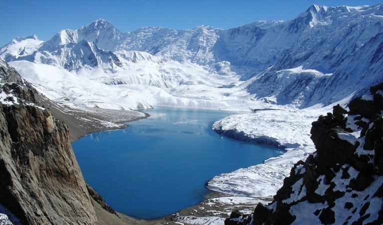
Tilicho Lake sits at 4,919m in the Annapurna region, about three days’ walk west of Manang. Most people visit it as a detour on the Annapurna Circuit, then rejoin the main trail to cross Thorong La. The trek is hard: you sleep above 4,000m for several nights, cross an exposed landslide section and climb about 770m on the lake day. The best months are October and November, then March to May.
- Lake altitude: 4,919m (16,138ft)
- Size: about 4km long and 1.2km wide
- Starting point: Manang, on the Annapurna Circuit
- Detour length: about 3 extra walking days
- Last village: Khangsar
- Overnight stops: Shree Kharka (about 4,060m) and Tilicho Base Camp (about 4,150m)
- Hardest parts: the landslide section and the lake day climb
- Permits: ACAP and TIMS, the same as the Annapurna Circuit
- Best time: October to November, March to May
- Guide: required for foreign trekkers
Last updated: October 2026
Most Annapurna Circuit trekkers walk straight from Manang to Thorong La. A few turn west instead, toward a huge glacial lake under the walls of Tilicho Peak. It adds a few days and some hard walking. In return you get one of the most remarkable places in the Himalaya, usually with far fewer people than on the main circuit trail.
Here’s what the trek is really like.
Where Is Tilicho Lake?
Tilicho Lake is in Manang district, inside the Annapurna Conservation Area. It sits west of Manang village, away from the main Annapurna Circuit trail. The lake is fed by glaciers from Tilicho Peak (7,134m) and the long ice ridge that runs from it.
There’s no road to the lake. You reach it on foot from Manang, through the village of Khangsar and the teahouses at Shree Kharka and Tilicho Base Camp.

How High Is Tilicho Lake?
Tilicho Lake is at 4,919m (16,138ft). You’ll sometimes see 4,949m quoted, but 4,919m is the figure most sources use.
It’s often called the highest lake in the world. That isn’t quite true, because there are smaller lakes higher up. A fairer way to put it is that Tilicho is one of the highest lakes of its size anywhere. It’s about 4km long, 1.2km wide and around 85m deep on average.
| Place | Approx. altitude |
|---|---|
| Manang | 3,540m |
| Shree Kharka | 4,060m |
| Tilicho Base Camp | 4,150m |
| Tilicho Lake | 4,919m |
| Thorong La | 5,416m |
Why People Go
- The scale. A deep blue lake with ice cliffs dropping straight into it is not something you see on many treks.
- Fewer people. Most circuit trekkers skip it, so even in October it’s usually much quieter than the main trail.
- The meaning. Some Hindu pilgrims identify Tilicho with Kak Bhusundi, a sacred lake linked to the Ramayana, and make the trip for this reason.
- More time high before the pass. The extra nights above 4,000m can be part of a good acclimatisation plan for Thorong La. They don’t guarantee you’re ready for the pass, though. Your pace, where you sleep and how you feel matter more than the number of nights.

The Route: How You Get to Tilicho Lake
Most people add Tilicho to the Annapurna Circuit after their rest day in Manang. The detour looks like this:
- Manang to Shree Kharka. Through Khangsar, the last proper village, then up to a small group of teahouses on a high pasture.
- Shree Kharka to Tilicho Base Camp. A short day, but it includes the landslide section.
- Tilicho Lake day. A pre-dawn climb to the lake, then back down. Most groups return to Base Camp or continue to Shree Kharka.
- Back to the main trail. Past Old Khangsar to Yak Kharka, where you rejoin the route to Thorong La.
From Yak Kharka it’s the normal circuit: Thorong Phedi, the pass at 5,416m and down to Muktinath.

On our trek, we sleep at Shree Kharka after the lake day, so the walk back to Yak Kharka the next day is shorter. For the full day by day, see our Tilicho Lake and Thorong La Pass Trek.
How Hard Is the Tilicho Lake Trek?
It’s hard, mainly because of altitude.
- You sleep high. Shree Kharka and Tilicho Base Camp are both above 4,000m, and you stay at that height for several nights before the pass.
- The lake day is long. It’s about a 770m climb from Base Camp to the lake, mostly on steep switchbacks, then all the way back down. Allow 7 to 8 hours.
- Then there’s the pass. Tilicho doesn’t replace Thorong La, it comes before it. You still have a 5,416m crossing a few days later.
You don’t need climbing skills or special gear in the main seasons. You do need good fitness, a steady pace and ideally some previous experience above 3,000m.
The Landslide Section
Between Shree Kharka and Tilicho Base Camp, the trail crosses about 1km of loose scree on a steep slope. Rocks can fall from above, and it’s the part most people worry about.
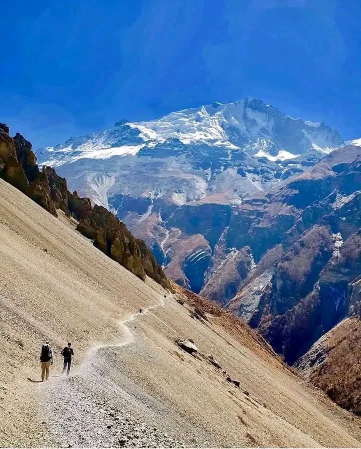
In stable conditions, trekkers cross it carefully with an experienced guide. A few simple rules help:
- Start early, when conditions are usually better.
- Keep a gap between you and the person in front.
- Watch the slope above you, not just the path.
- Follow your guide and avoid stopping in the most exposed parts.
- If rocks are falling or the slope looks unsafe, wait in a safe spot or turn back.
Rain, snow and ice make it more dangerous, which is one reason we don’t recommend this trek in the monsoon. Your guide checks the trail on the day and doesn’t assume it’s safe just because other groups have crossed.
Best Time to Visit Tilicho Lake
- October and November: the best months. Clear skies, stable weather and a fully open trail.
- March to May: also good. Warmer, with some snow possible higher up in early spring.
- December to February: not recommended. Snow can block the trail to the lake and close Thorong La.
- June to August: not recommended. Monsoon rain makes the landslide section much riskier.
The lake itself is often partly frozen until late spring.
Permits for Tilicho Lake
You don’t need a separate permit for Tilicho Lake. It’s inside the Annapurna Conservation Area, so you need the same permits as the Annapurna Circuit. For most foreign trekkers, the current fees are:
- Annapurna Conservation Area Permit (ACAP): NPR 3,000
- TIMS card: NPR 2,000
SAARC nationals pay less. A licensed guide and a TIMS card issued through a registered agency are required on the Annapurna Circuit. Fees and rules can change, so check before you go. When you book with us, we arrange your permits before you leave Kathmandu. See our Nepal trekking permits guide.
Teahouses and Food on the Tilicho Side
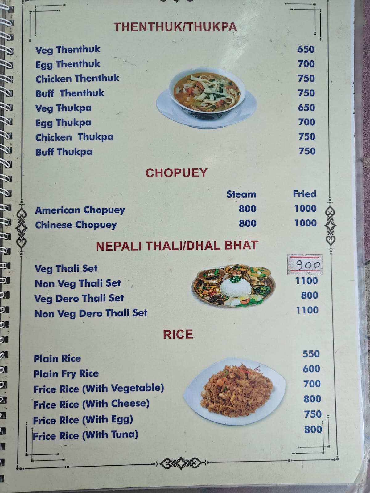
Accommodation at Shree Kharka and Tilicho Base Camp is very basic. Rooms are unheated, toilets are shared and electricity isn’t reliable. Bring a sleeping bag rated to at least -10°C, ideally -15°C.
Food is simple and more expensive than lower down, because everything is carried in. Dal bhat is the best choice. Budget around USD 40 to 50 a day for meals on this section.
Getting to Manang: Road Conditions
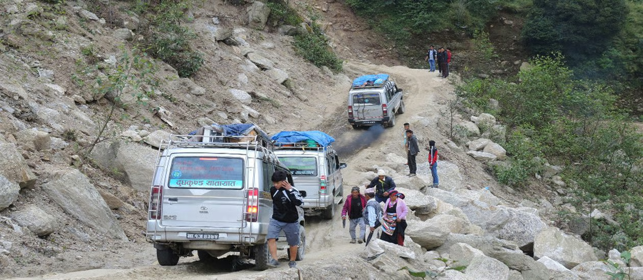
The road from Besisahar to Chame has been hit by landslides and flooding several times in 2026. In early October it reopened after a closure of about a week, but more disruption is possible after heavy rain.
Build some flexibility into your plans and check road conditions before you travel. If the road is blocked, vehicles may stop short and you walk the rest or switch transport. On our trek, the jeep goes as far as the road allows and we walk from there.
Frequently Asked Questions
How high is Tilicho Lake?
4,919m (16,138ft). You’ll sometimes see 4,949m, but 4,919m is the most widely used figure.
Is Tilicho Lake the highest lake in the world?
Not quite. There are smaller lakes higher up. Tilicho is one of the highest lakes of its size in the world.
How many days does the Tilicho Lake trek take?
The detour adds about three walking days to the Annapurna Circuit. Our full Tilicho Lake and Thorong La Pass Trek takes 18 days from Kathmandu.
Is the Tilicho Lake trek dangerous?
It has real risks, mainly altitude and the exposed landslide section. Good timing, a sensible itinerary and an experienced guide help manage them. Avoid the monsoon, when the landslide risk is highest.
Can I do Tilicho Lake without crossing Thorong La?
Yes. You can go to the lake and walk back to Manang, then drive out. Many people combine it with the pass, but it’s not required.
Do I need a guide for Tilicho Lake?
Yes. Foreign trekkers on the Annapurna Circuit need a licensed guide and a TIMS card issued through a registered agency.
Can you swim in Tilicho Lake?
We don’t recommend it. The water is freezing, and the lake is sacred to many Hindu pilgrims.
When is Tilicho Lake frozen?
Usually from winter into spring. It’s often partly frozen until April or May, and fully open in autumn.
Further Reading
- Annapurna Circuit Trek Cost
- Annapurna Circuit Best Time
- Annapurna Circuit Difficulty
- Annapurna Circuit Food Prices
- Kathmandu to Besisahar
- Altitude Sickness on Nepal Treks
- Nepal Trekking Permits
Last reviewed October 2026. Trail, road and permit details can change, so check with us before you travel.