
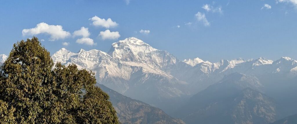
Dhaulagiri Icefall View Trek
Walk between Dhaulagiri (8,167m) and Annapurna (8,091m) through one of the deepest gorges on earth to Muktinath
On The Trail
What It Really Looks Like




Dhaulagiri Icefall View Trek — What to Expect
Watch the icefall hang off the 7th highest mountain in the world from Larjung and Kalapani below
Walk the Kali Gandaki between two 8,000m peaks separated by just 34km
108 water spouts and an eternal natural gas flame at 3,710m. Sacred to both Hindus and Buddhists
Marpha apple brandy, Kagbeni mud houses, and an ancient trade route to Tibet still walked today
This 15-day trek follows an ancient trade route from Pokhara to Muktinath through the Kali Gandaki valley, the gorge separating Dhaulagiri (8,167m) and Annapurna (8,091m). The route starts with the Poon Hill sunrise approach via Ghorepani, drops to the natural hot springs at Tatopani, then heads north through the deepest section of the gorge past Larjung and Kalapani where the Dhaulagiri Icefall hangs directly above the valley. It ends at Muktinath at 3,710m before a 20-minute flight back to Pokhara from Jomsom.
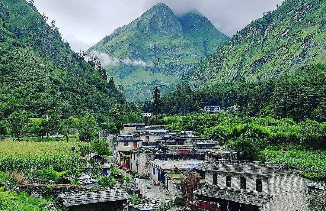
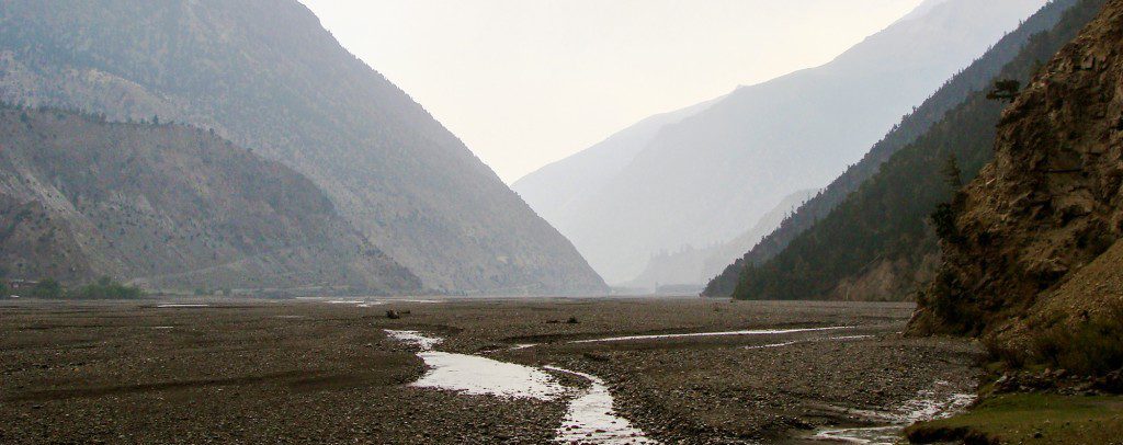
The landscape changes dramatically in four stages. Rhododendron forest and terraced hillsides from Nayapul to Ghorepani. The Kali Gandaki gorge with waterfalls and sheer rock walls from Tatopani to Ghasa. The high arid valley flanked by 8,000m peaks from Larjung to Jomsom. And the barren, windswept Mustang plateau from Kagbeni to Muktinath. The hardest days are Days 4 and 11. Daily walking averages 5 to 7 hours. Prior trekking experience is recommended but this is not a technical route.
Your MountainKick guide manages the pace, the teahouse bookings, and the early morning starts that the valley winds demand. Above Ghasa, afternoons are consistently windy. Your guide sets off early every day for good reason.
Trail highlights:
- Poon Hill sunrise at 3,210m: Dhaulagiri, Annapurna, Nilgiri, and Machhapuchhre lit by first light
- Tatopani hot springs on the Kali Gandaki riverbank, a natural rest point between the forest and gorge sections
- Larjung and Kalapani: the deepest section of the gorge with the Dhaulagiri Icefall hanging directly above
- Marpha: Nepal’s apple capital with whitewashed Thakali houses, a monastery, and locally made apple brandy
- Kagbeni: medieval mud-brick village on the boundary of restricted Upper Mustang with a 15th-century monastery
- Muktinath at 3,710m: 108 water spouts and an eternal natural gas flame sacred to Hindus and Buddhists
Read our Annapurna Circuit vs ABC guide for how this route compares to other Annapurna options.
Day-by-Day Itinerary
Arrival in Kathmandu
Your guide meets you at arrivals and transfers you to the hotel in Thamel. That evening we hold a pre-trip briefing covering the full route, kit check, and permit paperwork. Bring your passport. If you need last-minute gear, Thamel shops open from 8am and stock everything from trekking poles to sleeping bags.
Drive to Pokhara
The tourist bus departs at 7am from Sorakhutte near Thamel. The 200km drive along the Prithvi Highway takes 7 to 8 hours. Arrive in Pokhara by late afternoon with the evening free. Phewa Lake and the World Peace Pagoda are 10 minutes from most hotels. If you are prone to motion sickness take medication before boarding.
Drive to Nayapul, Trek to Tikhedhunga
A private vehicle takes you 42km to Nayapul in about an hour. ACAP and TIMS permits are checked at Birethanti, 30 minutes in. The trail follows the Bhurungdi Khola river before climbing to Tikhedhunga. A gentle first day with one short steep section near the end. Plenty of time to find your pace before tomorrow’s serious climb.
Trek to Ghorepani
The hardest day of the first half. The trail drops to cross the Bhurungdi Khola then climbs over 3,000 stone steps to Ulleri, the Magar village that tests every trekker. From Ulleri the path continues through dense rhododendron and oak forest via Banthanti to Ghorepani. Start early, set a steady pace, and use poles. Set an alarm for tomorrow.
Poon Hill Sunrise, Trek to Tatopani
Alarm at 4:30am for the 45-minute climb to Poon Hill at 3,210m. Dhaulagiri, Annapurna South, Nilgiri, and Machhapuchhre fill the horizon as first light hits the ridges. Back to Ghorepani for breakfast then a long descent through rhododendron forest and terraced farmland to Tatopani. The name means “hot water” in Nepali. Soak in the riverside springs before dinner.
Trek to Ghasa
The gorge begins today. The trail follows the Kali Gandaki north past Dana village and the Rupse Chhahara waterfall before entering the narrowest and deepest section of the canyon. Rock walls close in on both sides and the river roars below. Ghasa is a Thakali village at the base of the gorge where vegetation starts giving way to more arid terrain. A good place for birdwatchers.
Trek to Larjung
This is the day the Dhaulagiri Icefall appears. The trail climbs through pine forest past Lete village to Kalapani, where Dhaulagiri (8,167m) rises directly to the west and its icefall hangs visibly above the valley. From this point you are walking through the deepest section of the Kali Gandaki gorge, with two 8,000m peaks on either side. Larjung is a traditional Thakali stone village.
Trek to Marpha
A shorter morning as the valley opens and the landscape turns increasingly arid. The trail passes Tukuche, a former salt trading hub with four monasteries and a 15th-century gompa, then reaches Marpha through apple orchards. Marpha is Nepal’s apple capital with whitewashed Thakali houses, stone-paved alleys, a monastery, and distilleries producing the region’s famous apple brandy. Afternoon winds pick up early here.
Trek to Kagbeni
Pass through Jomsom, the district headquarters of Mustang and the largest settlement on the route. From Jomsom the landscape shifts to the barren Mustang plateau. The afternoon winds in the Kali Gandaki are powerful above Jomsom — stones roll, flags crack, and walking becomes a push. Kagbeni is a medieval mud-brick village on the border of restricted Upper Mustang with a red monastery dating to the 15th century.
Trek to Muktinath
The trail leaves the Kali Gandaki and climbs east through Jharkot, a Tibetan-style fortress village with an ancient monastery, before the final ascent to Muktinath. The temple complex has 108 water spouts carved as bull heads, an eternal natural gas flame, and a Buddhist monastery. Pilgrims from across South Asia bathe in the freezing water year-round as an act of devotion.
Trek back to Jomsom
Explore Muktinath temple at dawn before the pilgrims arrive then begin the descent back to Jomsom. The return is mostly downhill and much faster than the climb. Start before 9am to avoid the afternoon valley winds on the Jomsom approach. Your last night on the trail before tomorrow’s flight. Jomsom has good teahouses, shops, and a surprisingly well-stocked bakery.
Fly Jomsom to Pokhara
The 20-minute flight passes between Annapurna and Dhaulagiri at close range. Flights depart early before the valley winds build and are weather-dependent. Occasional cancellations happen, with a jeep ride as the alternative at 4 to 5 hours. Check into your hotel in Pokhara by mid-morning. The rest of the day is yours after 9 days on the trail.
Drive to Kathmandu, Farewell Dinner
The tourist bus follows the Prithvi Highway back to Kathmandu, 200km in 7 to 8 hours. Arrive by early evening. That night your guide takes you to a local restaurant for a farewell dinner of dal bhat, momos, and traditional Nepali dishes. A good moment to reflect on two 8,000m peaks, a medieval pilgrimage site, and the world’s deepest gorge.
Free Day in Kathmandu
A buffer day before departure. Use it for Kathmandu sightseeing, last-minute shopping in Thamel, or simply rest. Boudhanath stupa is 20 minutes by taxi and worth a morning visit. Pashupatinath temple on the Bagmati river is 15 minutes and one of the most important Hindu pilgrimage sites in South Asia. Your guide is available if you want a half-day tour arranged.
Final Departure.
Breakfast at the hotel then a private transfer to the airport timed to your flight. Luggage stored with us during the trek can be collected before you head out.
3D Route Map
Includes & Excludes
-
Airport transfers in Kathmandu Private vehicle, arrival and departure
-
3-star hotel in Kathmandu 2 nights, twin-sharing, breakfast included
-
3-star hotel in Pokhara 2 nights, twin-sharing, breakfast included
-
Teahouse accommodation on trek 9 nights, twin-sharing throughout
-
Tourist bus KTM to Pokhara return Both directions
-
Private vehicle Pokhara to Nayapul Trek start
-
Jomsom to Pokhara flight 20-min scenic flight
-
Tourist bus Pokhara to Kathmandu Return journey Day 16
-
Government-licensed trekking guide NTB-certified, English speaking, full trek
-
Porter service 1 porter per 2 trekkers, 20kg load limit
-
All staff costs Salary, insurance, equipment, food and accommodation
-
Annapurna Conservation Area Permit (ACAP) Required entry permit for the Annapurna region
-
TIMS card Trekkers' Information Management System
-
Oximeter and first aid kit Carried by guide throughout the trek
-
Farewell dinner in Kathmandu Traditional Nepali meal with your guide
-
Duffel bag Yours to keep as a souvenir
-
International flights To and from Kathmandu
-
Nepal visa fee 15 days $30 / 30 days $50 / 90 days $125, available on arrival
-
Travel insurance Mandatory. Must cover helicopter evacuation to at least 4,000m
-
All meals on trek Budget $25 to $35 per day. Teahouses serve breakfast, lunch and dinner
-
Lunch and dinner in Kathmandu and Pokhara Except the farewell dinner
-
Personal trekking gear Sleeping bag, trekking poles. Rentable in Kathmandu or Pokhara
-
Hot showers, Wi-Fi, battery charging Small charge at teahouses, typically $2 to $5 each
-
Guide and porter tips Customary. Roughly 10-15% of the trip price
-
Jomsom flight cancellation Jeep alternative
-
Personal expenses Snacks, bottled water, laundry, souvenirs
Enhance Your Trek
We Handle the Details — At No Extra Cost
Where You'll Sleep & What You'll Eat
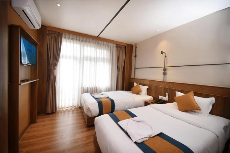
Three distinct tiers on this trek. Kathmandu and Pokhara are 3-star hotels with private bathrooms and breakfast included. From Tikhedhunga to Ghasa, teahouses are well-established with twin rooms, shared bathrooms, and solar hot water available. Tatopani has the best facilities on the lower section with natural hot springs a short walk from the village. Above Ghasa from Larjung through Marpha, Jomsom, and Kagbeni, teahouses are good with some attached bathrooms. Marpha and Jomsom have the best facilities on the upper section. Muktinath is the most basic stop — cold unheated rooms, shared bathrooms, and no reliable electricity. Sleeping bag rated to 0°C essential throughout.
- Kathmandu and Pokhara: 3-star hotel, private bathroom, breakfast included
- Tikhedhunga to Ghasa: established teahouses, shared bathroom, solar hot shower at extra cost
- Tatopani: natural hot springs on the Kali Gandaki riverbank, short walk from teahouses
- Larjung to Jomsom: good teahouses, some attached bathrooms, reliable dining
- Muktinath: basic unheated rooms, shared bathrooms, cold nights, bring all your layers to bed
- Sleeping bag rated to 0°C recommended throughout
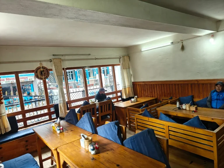
Teahouse menus are consistent from Tikhedhunga to Muktinath: dal bhat, garlic soup, noodle soup, fried rice, eggs, and ginger tea. From Ghasa northward expect Thakali cuisine, widely regarded as the best teahouse food in Nepal. In Marpha try the apple cider, brandy, and apple pie made from local orchards. Do not eat meat above Ghasa where freshness cannot be guaranteed. Budget $25 to $35 per day for three meals and drinks on trail.
| Meals on trail | $25 to $35 / day |
| Hot shower | $2 to $5 |
| Wi-Fi (where available) | $2 to $3 |
| Battery charging per device | $2 to $3 |
| Bottled water | $1 to $2 |
What Our Trekkers Say
“A serious adventure in the Himalayas”
The Dhaulagiri Icefall trek was one of the most challenging and rewarding trips we've done. The landscape felt genuinely wild, especially closer to the icefall and the higher camps. Our MountainKick team were experienced, calm, and professional throughout -- demanding days, but being in such a remote part of the…
Frequently Asked Questions
How difficult is the Dhaulagiri Icefall View Trek?
This trek is rated Challenging (Level 3 on our scale). Daily walking averages 5 to 7 hours on well-marked teahouse trails. The hardest days are Day 4, the 1,320m climb from Tikhedhunga to Ghorepani, and Day 5, a long descent from Poon Hill all the way to Tatopani. The maximum altitude is 3,710m at Muktinath, well below where serious altitude sickness becomes a major concern. No prior trekking experience is required but good cardiovascular fitness is important. If you can walk uphill steadily for 6 hours with a daypack, you can complete this trek. See our full trek difficulty guide for context.
Does this trek actually go to the Dhaulagiri Icefall?
No. The route does not approach the icefall on foot. This is a valley trek through the Kali Gandaki gorge between Dhaulagiri and Annapurna. From Larjung, Kalapani, and Tukuche you look directly up at the Dhaulagiri Icefall hanging off the south face of the mountain above the valley. The views are dramatic and close. The actual Dhaulagiri Circuit Trek, which approaches the icefall directly, is an entirely different route requiring camping gear, glacier crossings, and two high passes above 5,000m. This is not that route.
What is the best time to do this trek?
Spring (March to May) and autumn (September to November) are the two reliable windows. Autumn brings clear skies and the best mountain visibility after the monsoon clears. Spring is warmer with rhododendrons in bloom on the Ghorepani section. Avoid winter (December to February) when Muktinath gets snow and Jomsom flights are frequently cancelled. Avoid monsoon (June to August) when the lower gorge section between Tatopani and Ghasa receives heavy rainfall with landslide risk and leeches active on the Nayapul to Tikhedhunga section.
Can altitude sickness be a problem on this trek?
Altitude sickness is unlikely at the maximum elevation of 3,710m but some trekkers arriving from sea level experience mild headaches, fatigue, or disrupted sleep above 2,500m. Stay well-hydrated, maintain a steady pace, and avoid rushing the climb to Ghorepani on Day 4. Your guide carries an oximeter. Muktinath at 3,710m is the highest point and most trekkers feel fine there with the gradual ascent the itinerary provides. Read our full altitude sickness guide for a detailed breakdown of symptoms and prevention.
What makes this trek different from the standard Poon Hill Trek?
The Poon Hill Trek ends at Ghandruk after the sunrise viewpoint and takes 9 days. This trek continues north past Tatopani, through the Kali Gandaki gorge between Dhaulagiri and Annapurna, past the Thakali villages of Marpha and Kagbeni, and ends at Muktinath temple at 3,710m. You get the Poon Hill sunrise plus 9 more days of completely different terrain, culture, and landscape. The Kali Gandaki section is the most dramatic part of the route and the reason to choose this trek over the shorter Poon Hill option.
What are the Kali Gandaki valley winds like and how do they affect the trek?
The Kali Gandaki is famous for its afternoon winds. From Jomsom northward the winds pick up reliably after midday and walking into them is genuinely difficult. Your guide will start early every day from Day 9 onward so you reach each stop before the worst winds arrive. On the descent from Muktinath to Jomsom on Day 11 you walk with the wind at your back which makes life considerably easier. This is one of the practical reasons having an experienced guide matters on this route.
What permits do I need and are they included?
Two permits are required: the Annapurna Conservation Area Permit (ACAP) and the TIMS card. Both are included in the MountainKick package price. We handle all paperwork before you leave Kathmandu. Bring your passport and two passport-sized photos to the pre-trip briefing. Permits are checked at Birethanti near Nayapul and at several checkpoints through the valley. Carry your originals at all times. For full 2026 permit details read our Nepal trekking permits guide.
Is a licensed guide mandatory on this route?
Yes. Since April 2023 Nepal requires all foreign trekkers on designated routes including the Annapurna region to trek with a licensed guide. Beyond the legal requirement, the Kali Gandaki valley demands local knowledge — the wind timing, the teahouse network above Ghasa, and the early morning departure schedule from Jomsom northward all benefit from a guide who has walked this route many times. Your MountainKick guide manages the pace and the logistics so you can focus on the views.
What food is available on the trail?
Teahouse menus from Tikhedhunga to Muktinath serve dal bhat, garlic soup, noodle soup, fried rice, eggs, pancakes, and ginger tea. From Ghasa northward expect Thakali cuisine, widely regarded as the best teahouse food in Nepal. In Marpha try the apple products including cider, brandy, and apple pie made from local orchards. Do not eat meat above Ghasa where freshness cannot be guaranteed. Budget $25 to $35 per day for three meals and drinks on trail, slightly more at Muktinath where everything is jeep-carried in.
What is the Jomsom to Pokhara flight like and what if it is cancelled?
The 20-minute flight passes between Annapurna and Dhaulagiri at close range and is one of the most scenic mountain flights in Nepal. Flights depart early morning before the valley winds build and are weather-dependent. Cancellations happen, with a jeep ride of 4 to 5 hours as the alternative. Travel insurance is essential for this reason. We build enough flexibility into the itinerary to absorb a one-day delay without affecting your international departure.
What should I budget beyond the package price?
Budget for: international flights, Nepal visa (15-day $30 / 30-day $50 / 90-day $125), travel insurance, all meals on trek ($25 to $35 per day), hot showers and Wi-Fi ($2 to $5 each), guide tips ($8 to $12 per day) and porter tips ($5 to $8 per day). Withdraw all cash before leaving Pokhara as there are no ATMs on trail. Most trekkers spend an additional $350 to $450 on top of the $1,240 package price.
What travel insurance do I need?
Your policy must cover emergency helicopter evacuation to at least 4,000m. A helicopter evacuation from the Muktinath area without insurance can cost $2,000 to $3,500. Make sure your policy also covers trip cancellation, medical treatment, and flight delays — Jomsom flight cancellations are the most common disruption on this route. Carry a printed copy of your policy and emergency contact number throughout the trek. Read our travel insurance guide for what to look for.
Departure Dates & Pricing
No upcoming fixed departures are scheduled at the moment. Contact us to arrange a private departure on dates that suit you.
-
1
20% Deposit — Due on booking Secures your place on the departure. Refundable within cancellation window.
-
2
80% Balance — Due on arrival Pay the remainder in Kathmandu before the trip begins. Bank transfer, card, or cash accepted.
-
3
Bhutan & Tibet — Full payment 20 days prior Full balance required at least 20 days before departure for Bhutan and Tibet tours.
| 30+ days before departure | Deposit forfeited, balance refunded in full |
| 15–29 days before departure | 50% of total trip cost charged |
| Under 15 days | No refund |
| MountainKick cancels trip | Full refund or reschedule |
We give you the power to choose the departure date that suits your group best. A private trip is a perfect solution if you can’t find a published departure date that you and your companions agree on. You can set up a private departure for most of the trips we offer.
Ready to go? Request your preferred dates or message us directly on WhatsApp — we'll confirm availability within a few hours.
We never force our customers to follow our set itinerary. You can customize your itinerary exactly the way you want. Please share with us your ideas.
"*" indicates required fields
Packing List
| Item | Qty | Note |
|---|---|---|
| Waterproof hiking boots, ankle support | 1 pair | Must be broken in. Non-negotiable. |
| Merino wool hiking socks | 3 pairs | Never cotton. Merino manages moisture and odour. |
| Camp sandals or flip flops | 1 pair | For teahouses after long days. Marpha and Jomsom have good common areas to relax in |
| Item | Qty | Note |
|---|---|---|
| Moisture-wicking base layer top | 1 | Synthetic or merino. Never cotton. |
| Quick-dry trekking shirts | 2 | One on, one drying. Long sleeve offers sun protection on exposed valley sections above Jomsom |
| Fleece jacket | 1 | Main mid-layer. Worn every evening from Ghasa northward |
| Down or insulated jacket | 1 | Essential for cold evenings at Muktinath and Kagbeni. Rentable in Pokhara |
| Waterproof jacket with hood | 1 | Weather changes fast in the gorge section between Tatopani and Ghasa |
| Quick-dry trekking pants | 2 pairs | 2 pairs. Convertible zip-off works well as temperatures vary significantly between Tatopani and Muktinath. |
| Underwear, moisture-wicking | 4 pairs | Quick-dry synthetic or merino. |
| Item | Qty | Note |
|---|---|---|
| Sun hat or cap | 1 | UV is strong on exposed valley sections above Jomsom. No tree cover |
| Warm beanie | 1 | For cold evenings at Kagbeni and Muktinath and the pre-dawn temple visit |
| Fleece gloves | 1 pair | Hands get cold fast at Muktinath before sunrise |
| Neck gaiter or buff | 1 | Wind protection essential above Jomsom. The Kali Gandaki afternoon winds are powerful |
| Sunglasses, UV protection | 1 | Standard UV lenses sufficient. No glacier terrain on this route |
| Item | Qty | Note |
|---|---|---|
| Daypack, 20 to 25L with rain cover | 1 | Stays with you all day on trail. |
| Sleeping bag, rated to 0°C | 1 | Muktinath and Kagbeni are the coldest nights on this route. Rentable in Pokhara |
| Trekking poles | 1 pair | Critical for the Day 5 long descent from Poon Hill to Tatopani and the steep sections above Kagbeni |
| Headlamp with spare batteries | 1 | For the pre-dawn Poon Hill climb on Day 5 and the early morning temple visit at Muktinath |
| Reusable water bottle, 1L | 1 | Plastic bottles banned in the Annapurna Conservation Area. Boiled water available at all teahouses |
| Water purification tablets | 1 pack | Backup when boiled water is unavailable |
| Item | Qty | Note |
|---|---|---|
| Blister treatment, moleskin or second skin | 1 pack | Day 4 Ulleri steps and Day 5 long descent are the highest blister risk days. Start treating hot spots early |
| Pain relievers, paracetamol or ibuprofen | 1 pack | Ibuprofen useful for knee pain on the long descent sections |
| Anti-diarrheal tablets | 1 pack | Stomach issues common from food changes, particularly switching to Thakali cuisine above Ghasa |
| Sunscreen SPF 40 | 1 | Reapply on exposed valley sections above Jomsom. UV is intense with no tree cover |
| Lip balm with SPF | 1 | Lips crack fast in the cold dry air at Muktinath and Kagbeni |
| Item | Qty | Note |
|---|---|---|
| Microfiber towel | 1 | Teahouses do not provide towels |
| Toothbrush and toothpaste | 1 each | Travel size only |
| Hand sanitizer | 1 small | Not always water available before meals at smaller teahouses in the gorge section |
| Toilet paper | 2 rolls | Teahouses can run out above Ghasa. Always carry your own |
| Wet wipes | 1 pack | Hot showers above Kagbeni at Muktinath are cold and basic. Wet wipes cover the gap |
| Item | Qty | Note |
|---|---|---|
| Passport, valid 6 months | 1 | Keep a photocopy separate. |
| Trek permit copies, ACAP and TIMS | 1 set | We handle permits. Carry copies at Birethanti and all checkpoints through the valley |
| Travel insurance document | 1 | Must cover helicopter evacuation to 4,000m. Print a hard copy |
| Cash, Nepali rupees | As needed | Budget NPR 3,000 to 4,500 per day for meals plus showers, Wi-Fi, and charging. Higher above Ghasa |
| Item | Note |
|---|---|
| Sleeping bag rated to -10°C | Muktinath drops well below freezing in January and February. 0°C bag not sufficient in winter |
| Insulated waterproof gloves | Fleece gloves alone not enough for Muktinath in winter |
| Balaclava | Full face protection for the pre-dawn temple visit at Muktinath and the Jomsom valley winds |
| Extra thermal base layer | Third layer for cold nights above Kagbeni in winter months |
| Item | Note |
|---|---|
| Heavy waterproof gaiters | Mud and water on trail from Nayapul through the gorge section to Ghasa |
| Leech socks | Active from Nayapul to Tikhedhunga only. Not an issue above Ulleri. |
| Extra quick-dry layer | Nothing dries overnight in monsoon. |
Sleeping bags and down jackets can be rented in Pokhara before the trek. Trekking poles are best purchased in Thamel or Pokhara. We connect you with trusted shops at the pre-trip briefing. A duffel bag is provided to every trekker as part of the package
What Not to Bring
Dhaulagiri Icefall View Trek
Kumar and the team have guided this route for over a decade. Ask anything — gear, fitness, altitude, private groups — before you commit.

Tales from the Himalayas
Fresh stories and expert insights from our mountain adventures
WiFi and Internet on Nepal Trekking Trails: What to Expect (2026)
Realistic look at WiFi, Everest Link, and mobile data on Nepal's trails, including Everest, Annapurna, and Manaslu, with costs and where signal drops.

Everest Region, Essentials, Travel
Is Everest Base Camp Trek Hard? A Straight Answer From 20+ Years of Guiding
Everest Base Camp is rated Hard, but not for the reason most people assume. A guide with 20+ years on this route breaks down what actually causes trouble on the trail, and it's rarely fitness.
Is It Safe to Travel to Nepal After the Flood? September 2026 Travel & Trekking Update
Rasuwa and Manaslu floods explained: what's actually affected in Nepal, and why Everest, Annapurna, and most trekking regions remain open.