Larkya La Pass: A Guide to the Big Day on the Manaslu Circuit
Larkya La is the highest point of the Manaslu Circuit, at about 5,160m. You cross it in one long day from Dharamsala (4,460m) to Bimthang (3,720m), usually starting around 4am. The whole day is roughly 16km and often takes 8 to 10 hours, sometimes more. It’s non-technical, but the altitude, cold and long descent make it the hardest day of the trek.
- Height: about 5,160m. Published figures vary from about 5,106m to 5,160m.
- Start point: Dharamsala, also called Larkya Phedi, 4,460m
- Usual start: around 4am, depending on weather and conditions
- Whole day: roughly 16km, often 8 to 10 hours or more
- Descent: about 1,440m from the pass to Bimthang
- Best months: October to November and March to April
- Last updated: October 2026
Every Manaslu Circuit trekker remembers the day they cross Larkya La. It’s a long climb in the dark and the cold, prayer flags at the top with huge views, then a descent that goes on far longer than you expect.
Here’s what the day is really like and how to get through it well.
Where Is Larkya La?
Larkya La sits north of Manaslu, near the Tibetan border. It connects the Budhi Gandaki valley on the Manaslu side with the Dudh Khola valley, which leads down to the Annapurna region at Dharapani.
You’ll see different heights for the pass, from about 5,106m to 5,160m, depending on the map or source. We use about 5,160m on our trip pages. Either way, it’s the highest point of the trek.
Which Direction Do You Cross?
Almost everyone does the Manaslu Circuit anticlockwise. You walk up from Samdo to Dharamsala, climb to the pass the next morning, then descend to Bimthang. This is the standard route, and it means you’ve had time to acclimatise in the upper Budhi Gandaki valley before the big day.
The Night at Dharamsala
Dharamsala, also called Larkya Phedi, isn’t a village. It’s a small group of basic lodges at the foot of the pass, at 4,460m.
- Rooms are usually small, unheated twins with thin walls.
- Toilets are shared and basic, and washing facilities are very limited.
- The dining room is usually the only warm place, so everyone eats early and goes to bed early.
- In busy periods the lodges can fill up, and some trekkers may sleep in tents.
Expect a cold night with little sleep. That’s normal at this height before a big day. On our trek, our team arranges your room here like every other night.
What Crossing Day Is Like
The start. Most groups leave around 4am, but your guide decides the time based on the weather, daylight and trail conditions. It’s very cold, often well below freezing, and it can be windy.
The climb. The trail climbs over glacial moraine and past small frozen lakes, with several false tops. The first hours are slow, in the dark on a narrow trail, with most groups leaving at the same time. In some seasons there’s a small tea hut partway up, but it’s not always open, so don’t rely on it for food or shelter.
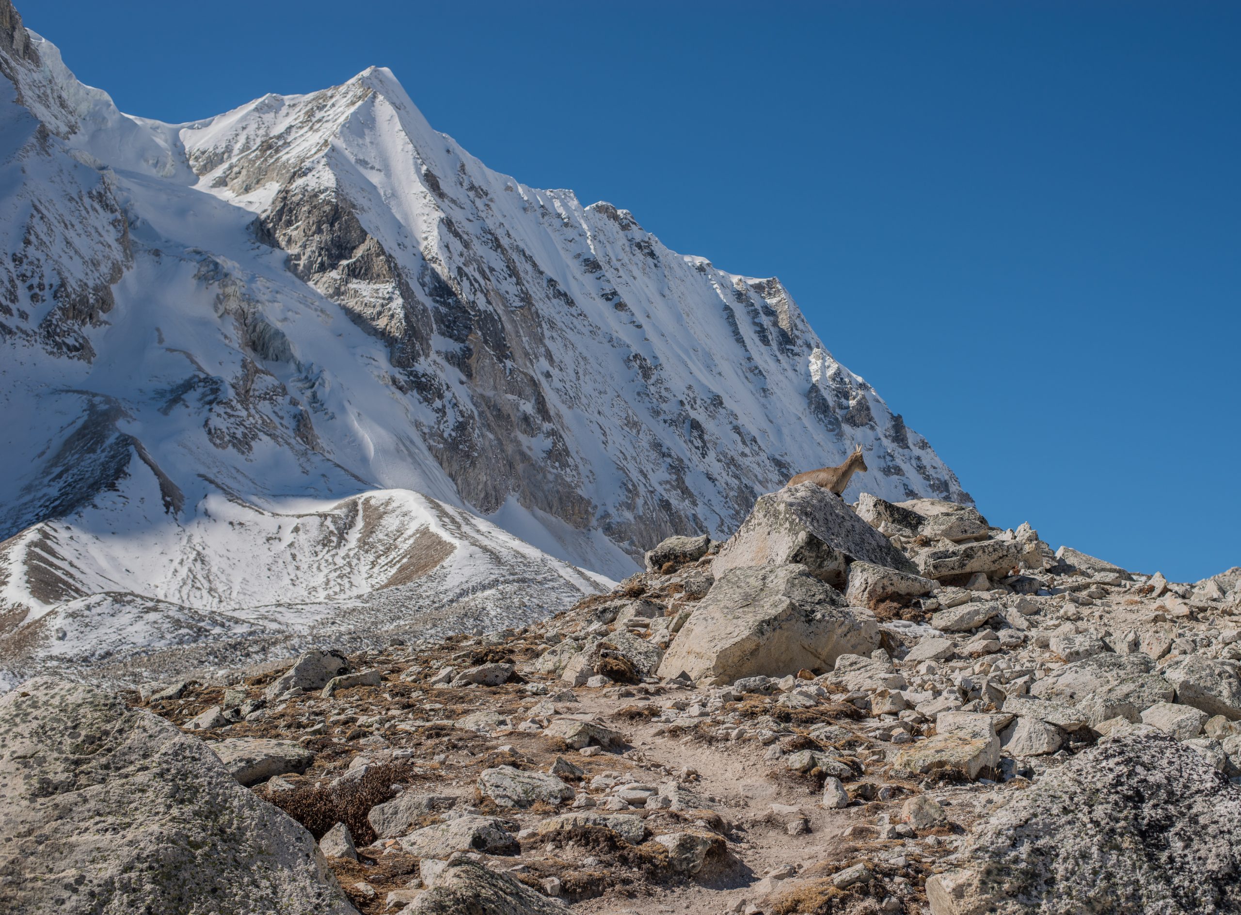
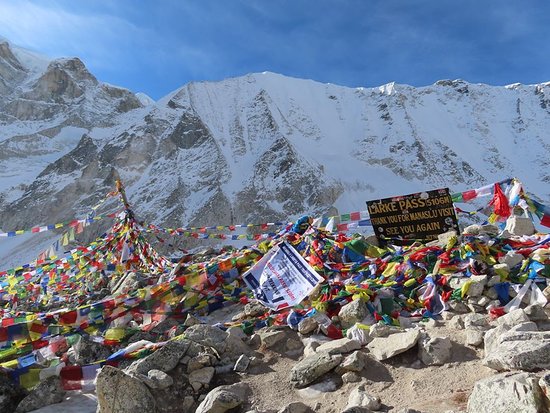
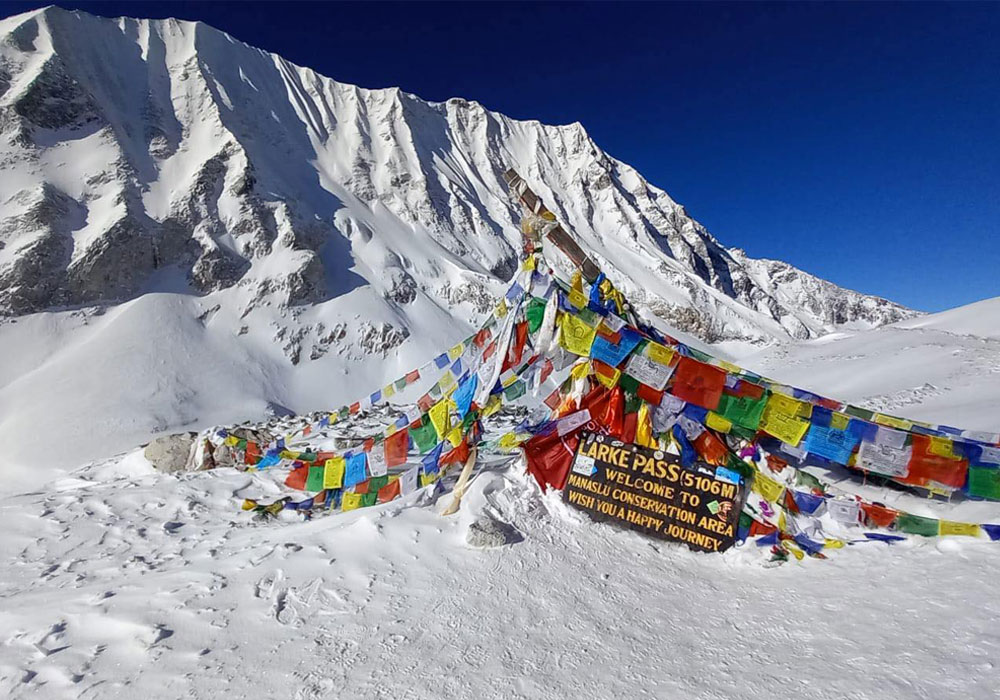
The top. Prayer flags and views of Himlung Himal, Cheo Himal, Kang Guru and Annapurna II. It’s usually windy and cold, so most groups take photos and start down soon.
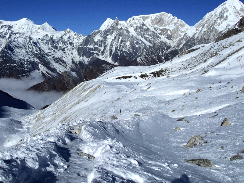
The descent. This is where many people struggle. It’s steep at first, with loose gravel and sometimes snow and ice, then it eases onto moraine and grassy paths. You lose about 1,440m from the top to Bimthang, on tired legs.
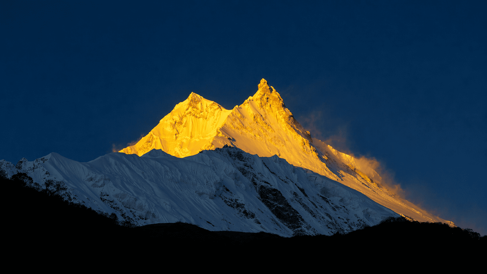
Bimthang (3,720m). A wide glacial valley with Manaslu behind you, a warm dining room and a much easier night’s sleep.
How Hard Is Larkya La?
It’s non-technical. There are no ropes and no climbing. But it’s the hardest day of the Manaslu Circuit.
- Altitude. You start at 4,460m and climb above 5,100m.
- Length. Often 8 to 10 hours or more, after a poor night’s sleep.
- The descent. It’s steep and long, and hard on the knees.
- Snow and ice. Possible near the top and on the first part of the descent. How much there is varies a lot from year to year and week to week.
Larkya La is lower than Thorong La (5,416m) on the Annapurna Circuit, but many trekkers find it just as hard because of the long, steep descent. How hard it feels depends mostly on your acclimatisation. Our Manaslu Circuit Trek includes an active acclimatisation day at Samagaon and a short day to Samdo before you go higher. See our Manaslu Circuit difficulty guide.
Best Time to Cross Larkya La
- October and November: the best months, usually with clear skies. It gets colder from mid-November.
- March and April: the next best. There can be more snow on the pass early in spring.
- May: possible, but afternoons are often cloudy.
- December to February: the pass may become impassable after heavy snowfall, so we don’t run winter group departures.
- June to August: the monsoon. Not recommended, and snow can fall on the pass even then.
See our best time for the Manaslu Circuit guide.
Safety on Larkya La
- Report symptoms early. Tell your guide straight away about headaches, nausea, dizziness or unusual weakness. If symptoms get worse, you don’t go higher.
- Know the serious signs. Confusion, trouble walking in a straight line, or breathlessness even at rest need urgent attention and descent. Going slower isn’t enough.
- Weather decides. If there’s heavy snow or a storm, your guide may wait or change the plan. That’s the right call, not a failure.
- Start time matters, but isn’t a guarantee. An early start gives you more daylight. Weather can still change on the pass at any time.
- Insurance. Your policy must cover trekking at this altitude and helicopter evacuation. See our travel insurance guide.
For more on symptoms, see our altitude sickness guide.
What to Bring on Pass Day
- Down jacket, thermal layers, a warm hat and a balaclava or buff
- Waterproof outer gloves with liner gloves
- Thermal socks and broken-in boots
- Microspikes if your guide advises them for current conditions
- Gaiters if there’s snow
- Headlamp with fresh batteries
- Sunglasses and sunscreen, because snow glare is strong
- Trekking poles for the descent
- At least 2 litres of water in an insulated bottle, and snacks
For the full list, see our Nepal trekking packing list.
Tips for Crossing Larkya La
- Pack your daypack and lay out your clothes the night before.
- Eat breakfast even if you don’t feel hungry.
- Keep your water bottle inside your jacket so it doesn’t freeze.
- Go slow and steady on the way up. Don’t try to keep up with faster groups.
- Use your poles and take your time on the first steep section down.
- Keep your phone in an inside pocket. Batteries die fast in the cold.
Frequently Asked Questions
How high is Larkya La Pass?
About 5,160m. Published figures vary from about 5,106m to 5,160m. It’s the highest point of the Manaslu Circuit.
How long does it take to cross Larkya La?
Often 8 to 10 hours or more from Dharamsala to Bimthang, roughly 16km. Snow, weather and pace can make it longer.
Is Larkya La harder than Thorong La?
It’s lower, but many trekkers find it just as hard because the descent to Bimthang is long and steep.
Do you need crampons for Larkya La?
Not usually. Microspikes can help on icy trail sections, and your guide will tell you if you need them. They aren’t a substitute for safe conditions. In heavy snow, the right call may be to wait.
Where do you stay before crossing Larkya La?
At Dharamsala, also called Larkya Phedi, at 4,460m. It’s a small group of basic lodges.
Is Larkya La open in winter?
It can become impassable after heavy winter snow, so we don’t run winter group departures.
Can beginners cross Larkya La?
It’s best for people who have done a multi-day trek before. It’s non-technical, but long, high and cold.